How ESA helps South Africa share water fairly
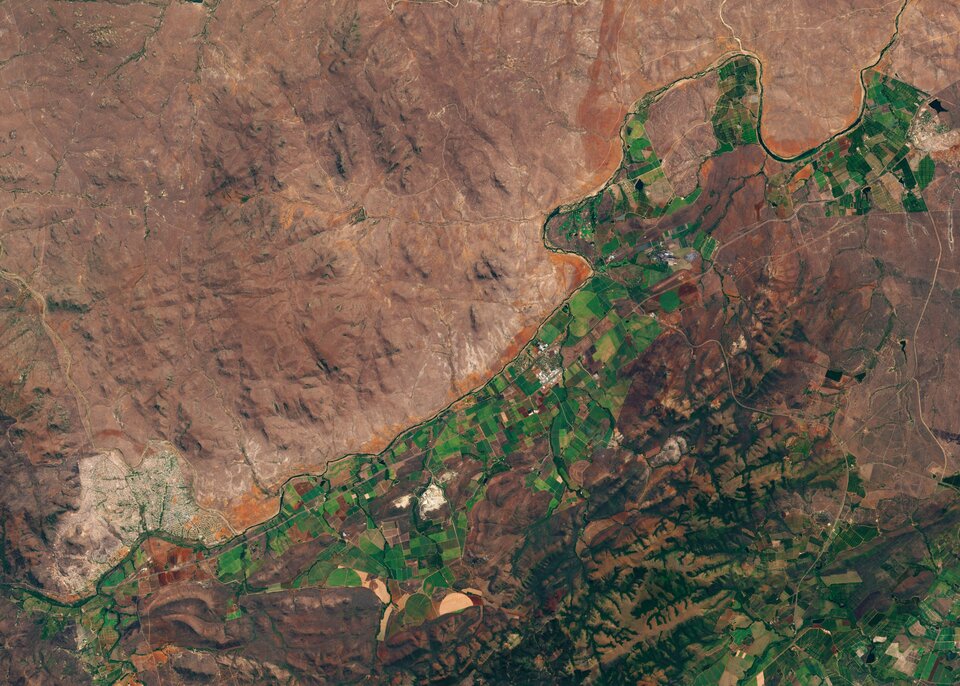
Clustered at the edge of the Crocodile River in Mpumalanga Province, South Africa, stand thousands of farms and small holdings growing fresh fruit and sugar cane. Water to irrigate the crops is taken from the river, but this slows its flow rate and leaves less for those downstream.
On World Water Day, how can the government achieve the sustainable use of water for the benefit of all South Africans? ESA has been working in partnership with two Dutch companies and a South African catchment management authority to find a solution.

Some 20 year ago, in response to severe water shortages, the South African government passed the National Water Act, which is intended to restrict the amount of water farmers use for irrigation.
However ensuring that farmers only take the water to which they are entitled is tricky.
Maurits Voogt, who works for HydroLogic, a relatively small company based in Amersfoort in the Netherlands, says: “It is a major task to monitor and enforce the legal use of water in places where there are limited qualified personnel available, and the areas that need to be monitored are huge.
“We have developed a smart, satellite-based water auditing service as part of ESA’s programme of Advanced Research in Telecommunications Systems (ARTES). It allows water management authorities to monitor irrigated water use in large areas without actually needing to visit every single farm.
“By doing so, the water auditing application helps them implement regulatory measures effectively, and thereby supports the sustainable use of water resource.”

The water auditing service uses evapotranspiration data calculated from satellite imagery by partner company eLEAF, based in Wageningen.
Combined with rainfall data from rain gauges and satellites, this evapotranspiration data is used to calculate how much water is used for irrigation. The application automatically compares the water use with data taken from a national water use register that lists the amount of water allocated to each farm.
In a pilot project, staff from HydroLogic and eLEAF used the technology to study irrigated water use for more than 50 000 fields covering some 40 000 square kilometres—about the area of the Netherlands.
The team analysed a handful of farms to confirm that the system could identify which farms had used large volumes of water compared to their neighbours.
The costs of the pilot project were shared between ESA, eLEAF, Hydrologic and the Inkomati-Usuthu Catchment Management Authority, which is responsible for managing water resources in the region through which the Crocodile River flows.
Following the demonstration project, the Inkomati-Usuthu Catchment Management Authority signed ongoing contracts for the water auditing service.
Tendai Sawunyama, manager of resource planning and operations for the Inkomati-Usuthu Catchment Management Authority, says: “The application allows water managers to prioritise where to investigate for over-usage or illegal abstraction of water, and to make better decisions on where to place water meters. It can improve the understanding of water use and water allocation, and therefore help to create more sustainable water use in agriculture.”
The water auditing application has been rolled out across South Africa to all catchment management authorities. It is now being modified to cater for the different user requirements needed by regional water authorities in Colombia and the Netherlands.
It was developed with the support of ESA Space Solutions through the ESA Business Applications programme.


 Germany
 Austria
 Belgium
 Denmark
 Spain
Spain
 Estonia
 Finland
 France
 Greece
 Hungary
 Ireland
 Italy
Italy
 Luxembourg
 Norway
 The Netherlands
 Poland
 Portugal
 Czechia
 Romania
 United Kingdom
 Slovenia
 Sweden
 Switzerland


