About ESA
The European Space Agency (ESA) is Europe’s gateway to space. Its mission is to shape the development of Europe’s space capability and ensure that investment in space continues to deliver benefits to the citizens of Europe and the world.
Highlights


Latest


Space in Member States
Find out more about space activities in our 23 Member States, and understand how ESA works together with their national agencies, institutions and organisations.
 Germany
 Austria
 Belgium
 Denmark
 Spain
Spain
 Estonia
 Finland
 France
 Greece
 Hungary
 Ireland
 Italy
Italy
 Luxembourg
 Norway
 The Netherlands
 Poland
 Portugal
 Czechia
 Romania
 United Kingdom
 Slovenia
 Sweden
 Switzerland
Science & Exploration
Exploring our Solar System and unlocking the secrets of the Universe
Go to topicAstronauts


Latest


Enabling & Support
Making space accessible and developing the technologies for the future
Go to topicLatest


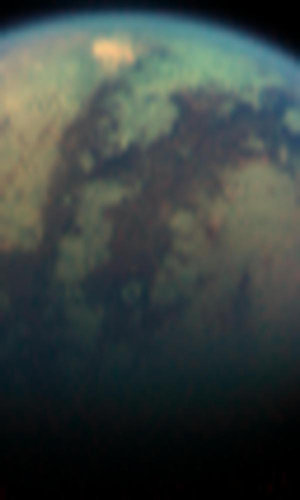
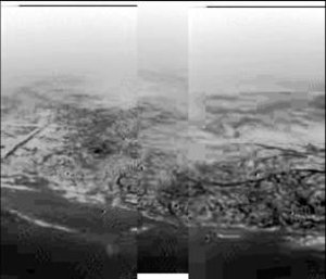
First view of Titan from Cassini-Huygens
The two images displayed here show Titan from a vantage point 17 degrees below its equator, yielding a view from latitude 50 degrees north all the way to its south pole.
The image on the left was taken four days after the image on the right, so Titan had rotated 90 degrees in that time and the two images combined cover a region extending halfway around the moon. The observed brightness variations suggest a diverse surface, with variations in average reflectivity on scales of a couple hundred kilometres.
The superimposed grid shows the orientation of Titan as well as the geographical regions of the satellite that are illuminated and visible. The yellow curve marks the position of the boundary between day and night.
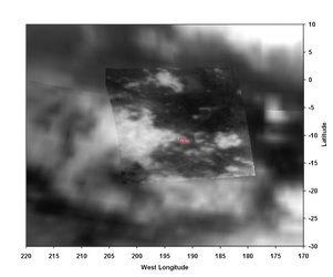
Also shown here is a map of relative surface brightness variations on Titan as measured in images taken by NASA/ESA’s Hubble Space Telescope. These images have scales of 300 kilometres per pixel. The colours indicate different surface reflectivities. From darkest to brightest, we have: deep blue (darkest), light blue, green, yellow, red and deep red (brightest).
The large continent-sized red feature is called Xanadu. It is unclear whether Xanadu is a mountain range, giant basin, smooth plain, or a combination of all three. It may be dotted with hydrocarbon lakes but that is also unknown. All that is presently known is that in Earth-based images, it is the brightest region on Titan.
Xanadu is visible as a bright region in the Cassini image on the right. The dark blue feature running from the north-west to the south-east (210°-250°W), and the bright yellow/green region to the east and southeast of it, can both be seen in the Cassini image on the left. The Huygens landing site is shown as an ellipse at longitude 188°-208°W, latitude 10.5°S (with the small uncertainty depending mainly on winds).