Agency
Comparison of Tharsis region geology, then and now
This map shows an excellent match between the geological structure of the Tharsis region on present-day Mars (left), where glaciers remnants are indicated in yellow, and a simulation of glacier formation by atmospheric precipitation in the same region a few millions year ago (right).
In the simulation, performed by a Martian climate computer modelling tool, it is assumed that the rotation axis of the planet was tilted by 45º with respect to the planet’s orbital plane, about 20º more than today. Here, the results of the simulation are superimposed on a topographical map of the Tharsis area made by NASA's Mars Global Surveyor MOLA altimeter.
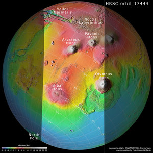
Topography of Tharsis region on Mars
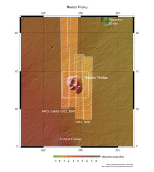
Tharsis Tholus in context

Topography and context of Tharsis and surroundings

Daedalia Planum context