About ESA
The European Space Agency (ESA) is Europe’s gateway to space. Its mission is to shape the development of Europe’s space capability and ensure that investment in space continues to deliver benefits to the citizens of Europe and the world.
Highlights


Latest


Space in Member States
Find out more about space activities in our 23 Member States, and understand how ESA works together with their national agencies, institutions and organisations.
 Germany
 Austria
 Belgium
 Denmark
 Spain
Spain
 Estonia
 Finland
 France
 Greece
 Hungary
 Ireland
 Italy
Italy
 Luxembourg
 Norway
 The Netherlands
 Poland
 Portugal
 Czechia
 Romania
 United Kingdom
 Slovenia
 Sweden
 Switzerland
Science & Exploration
Exploring our Solar System and unlocking the secrets of the Universe
Go to topicAstronauts


Latest


Enabling & Support
Making space accessible and developing the technologies for the future
Go to topicLatest


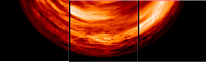
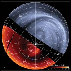
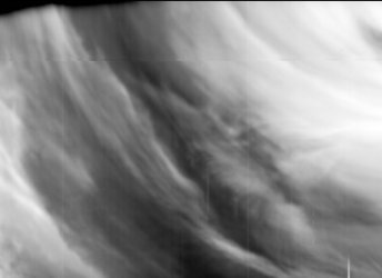
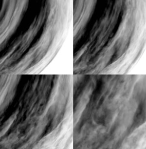
Tracking clouds in the Venusian night
These infrared images were taken by the Ultraviolet/Visible/Near-Infrared spectrometer (VIRTIS) on board ESA’s Venus Express on 25 April 2006, while the spacecraft was flying over low planetary latitudes (between 15º and 60º south).
The two images on the left panel (taken at 2.3 and 1.7 microns, respectively) show a fine atmospheric structure below the Venusian cloud deck, at about 35 and 20 kilometres altitude, respectively.
The right panel is the result of the projection on geographical coordinates of the second image of the left panel. The images at the top where taken from a distance of about 6000 kilometres from the surface, allowing VIRTIS to generate the high resolution details visible at the top of the panel. While Venus Express continued flying over the planet it got farer from the surface – up to 20 000 kilometres distance – allowing VIRTIS to obtain a wider view, but in lower resolution.
Stripe-like features are visible at the bottom of all images. They could be indicative of a wave-like atmospheric motion (due to tidal forces?), but their nature is still unexplained.
The separate images can be downloaded here:
[Cloud_tracking_infrared_b_H.tif,
Cloud_tracking_infrared_c_H.tif,
Wind_tracking_b_H.tif]