
Agency
First assessment of burnt areas
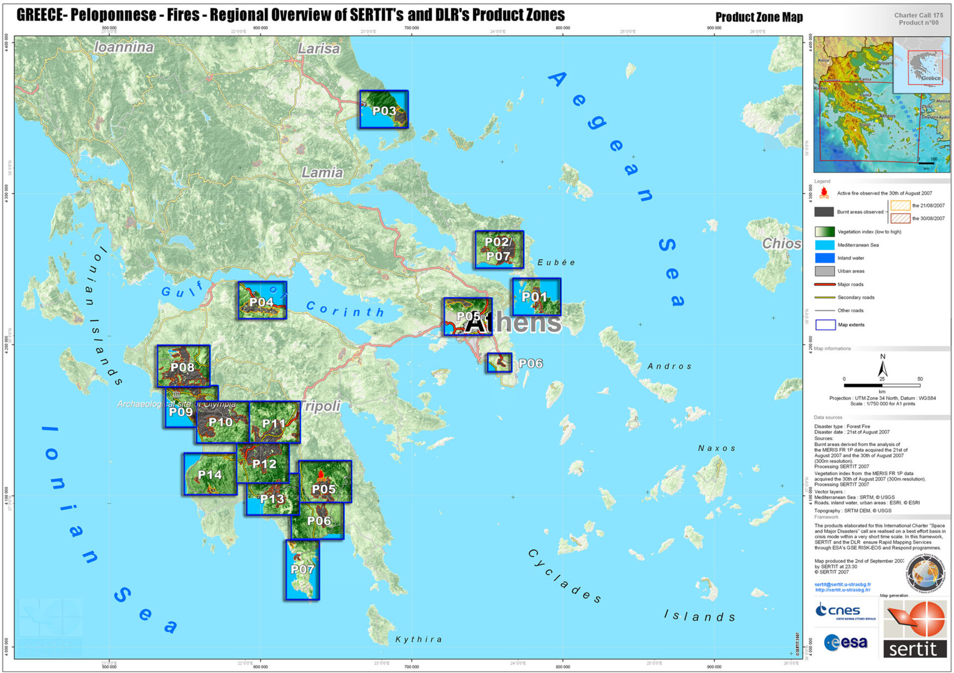
First assessment of burnt areas generated by SERTIT using Envisat MERIS Full Resolution data from 21 and 30 august 2007 and an overview of the 16 areas of the total damage mapping work conducted by the coordinated European providers group.
(EO Data copyright: ESA)


