About ESA
The European Space Agency (ESA) is Europe’s gateway to space. Its mission is to shape the development of Europe’s space capability and ensure that investment in space continues to deliver benefits to the citizens of Europe and the world.
Highlights


Latest


Space in Member States
Find out more about space activities in our 23 Member States, and understand how ESA works together with their national agencies, institutions and organisations.
 Germany
 Austria
 Belgium
 Denmark
 Spain
Spain
 Estonia
 Finland
 France
 Greece
 Hungary
 Ireland
 Italy
Italy
 Luxembourg
 Norway
 The Netherlands
 Poland
 Portugal
 Czechia
 Romania
 United Kingdom
 Slovenia
 Sweden
 Switzerland
Science & Exploration
Exploring our Solar System and unlocking the secrets of the Universe
Go to topicAstronauts


Latest


Enabling & Support
Making space accessible and developing the technologies for the future
Go to topicLatest


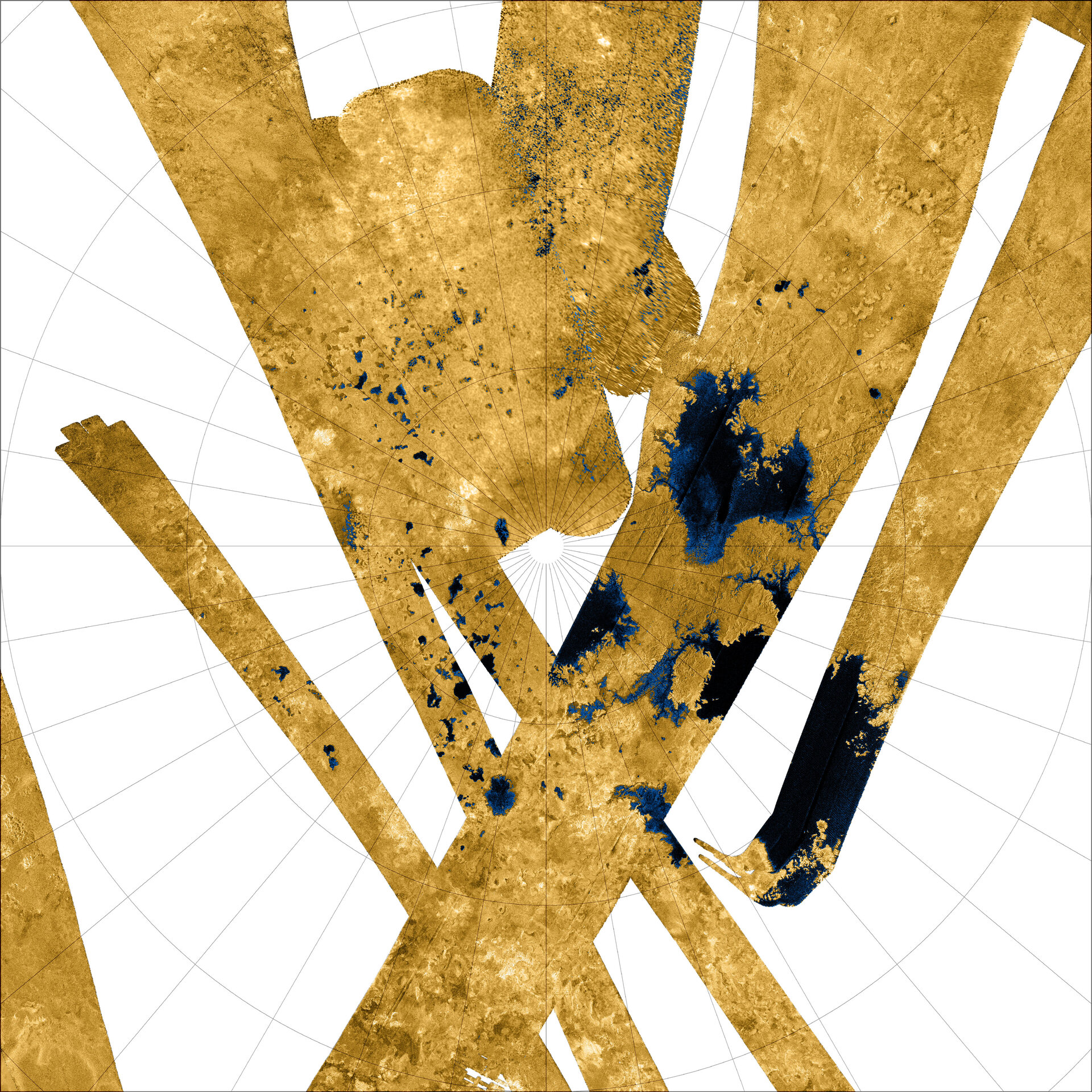
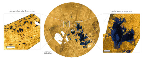
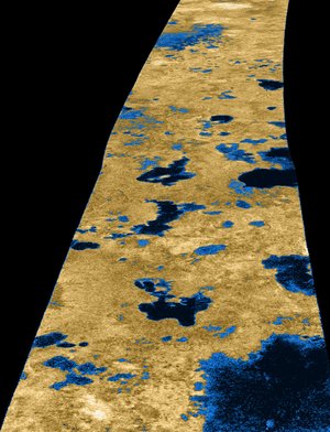
Titan's north polar region
This Cassini false-colour mosaic shows all synthetic-aperture radar images to date of Titan's north polar region. Approximately 60% of Titan's north polar region, above 60° north, is now mapped with radar. About 14% of the mapped region is covered by what is interpreted as liquid hydrocarbon lakes.
Features appearing darkest to the radar, which are thought to be liquid, are shown in blue and black, and the radar-bright areas likely to be solid surface are tinted brown. The terrain in the top centre of this mosaic is imaged at lower resolution than the remainder of the image.
Most of the many lakes and seas seen so far are contained in this image, including the largest known body of liquid on Titan. These seas are most likely filled with liquid ethane, methane and dissolved nitrogen.
Many bays, islands and presumed tributary networks are associated with the seas. The large feature in the upper right centre of this image is at least 100 000 square kilometers in area, greater in extent than Lake Superior (82 000 square kilometers), one of Earth's largest lakes. This Titan feature covers a greater fraction of the surface, at least 0.12%, than the Black Sea, Earth's largest terrestrial inland sea, at 0.085%. Larger seas may exist, as it is probable that some of these bodies are connected, either in areas unmapped by radar or under the surface.
Of the 400 observed lakes and seas, 70% of their area is taken up by large ‘seas’ greater than 26 000 square km.