About ESA
The European Space Agency (ESA) is Europe’s gateway to space. Its mission is to shape the development of Europe’s space capability and ensure that investment in space continues to deliver benefits to the citizens of Europe and the world.
Highlights


Latest


Space in Member States
Find out more about space activities in our 23 Member States, and understand how ESA works together with their national agencies, institutions and organisations.
 Germany
 Austria
 Belgium
 Denmark
 Spain
Spain
 Estonia
 Finland
 France
 Greece
 Hungary
 Ireland
 Italy
Italy
 Luxembourg
 Norway
 The Netherlands
 Poland
 Portugal
 Czechia
 Romania
 United Kingdom
 Slovenia
 Sweden
 Switzerland
Science & Exploration
Exploring our Solar System and unlocking the secrets of the Universe
Go to topicAstronauts


Latest


Enabling & Support
Making space accessible and developing the technologies for the future
Go to topicLatest


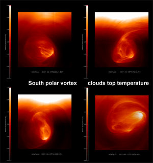
Temperature map of the south polar vortex
This temperature map of the south polar vortex was made with data from the Visible and Infrared Thermal Imaging Spectrometer (VIRTIS) on board ESA’s Venus Express.
The image, taken on both night and day sides, shows the colour-coded brightness temperature (in Kelvin) of the dipole and of the cold-collar region at 5.05 micrometres.
The level curves in the image are the real atmospheric temperatures retrieved from VIRTIS from the atmospheric layer at about 60-km altitude.
The warmer region corresponds to the ellipse containing the dipole where the highest temperature (250K) is observed in the centre of rotation of the dipole itself, on the left side. The coldest region of the polar collar with temperatures of about 210K is registered on the right side, at the morning
terminator.
The right graph shows the vertical atmospheric temperature profile in two different regions. The green curve corresponds to the green spot on the left image, inside the polar collar region. The red curve corresponds to the red spot inside the dipole.
At this altitude the temperature of the polar region is the highest on the whole planet. Also, the most prominent turbulence is observed here.
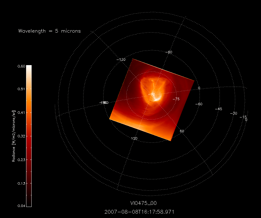
This image, taken at around midnight local time, at 1.7-micrometres, reveals what is present at an altitude of 45-50 km in the south polar region. It is possible to see that the cloud curtain is very thick and opaque.
The imaged area is located between 40º south (bottom of the image) and 80º south (top) image top.