
Applications
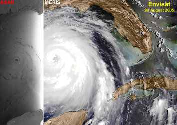
Hurricane Ike captured by Envisat
Thanks to Envisat’s unique capability to acquire optical and radar imagery over the same area of the Earth simultaneously, the top and bottom of a hurricane can be viewed at the same time. This unique view of Hurricane Ike is an example of combined optical MERIS and radar ASAR images, acquired on 9 September 2008 and showing the swirling cloud-tops and the shape of the wind-driven sea surface.


