About ESA
The European Space Agency (ESA) is Europe’s gateway to space. Its mission is to shape the development of Europe’s space capability and ensure that investment in space continues to deliver benefits to the citizens of Europe and the world.
Highlights


Latest


Space in Member States
Find out more about space activities in our 23 Member States, and understand how ESA works together with their national agencies, institutions and organisations.
 Germany
 Austria
 Belgium
 Denmark
 Spain
Spain
 Estonia
 Finland
 France
 Greece
 Hungary
 Ireland
 Italy
Italy
 Luxembourg
 Norway
 The Netherlands
 Poland
 Portugal
 Czechia
 Romania
 United Kingdom
 Slovenia
 Sweden
 Switzerland
Science & Exploration
Exploring our Solar System and unlocking the secrets of the Universe
Go to topicAstronauts


Latest


Enabling & Support
Making space accessible and developing the technologies for the future
Go to topicLatest


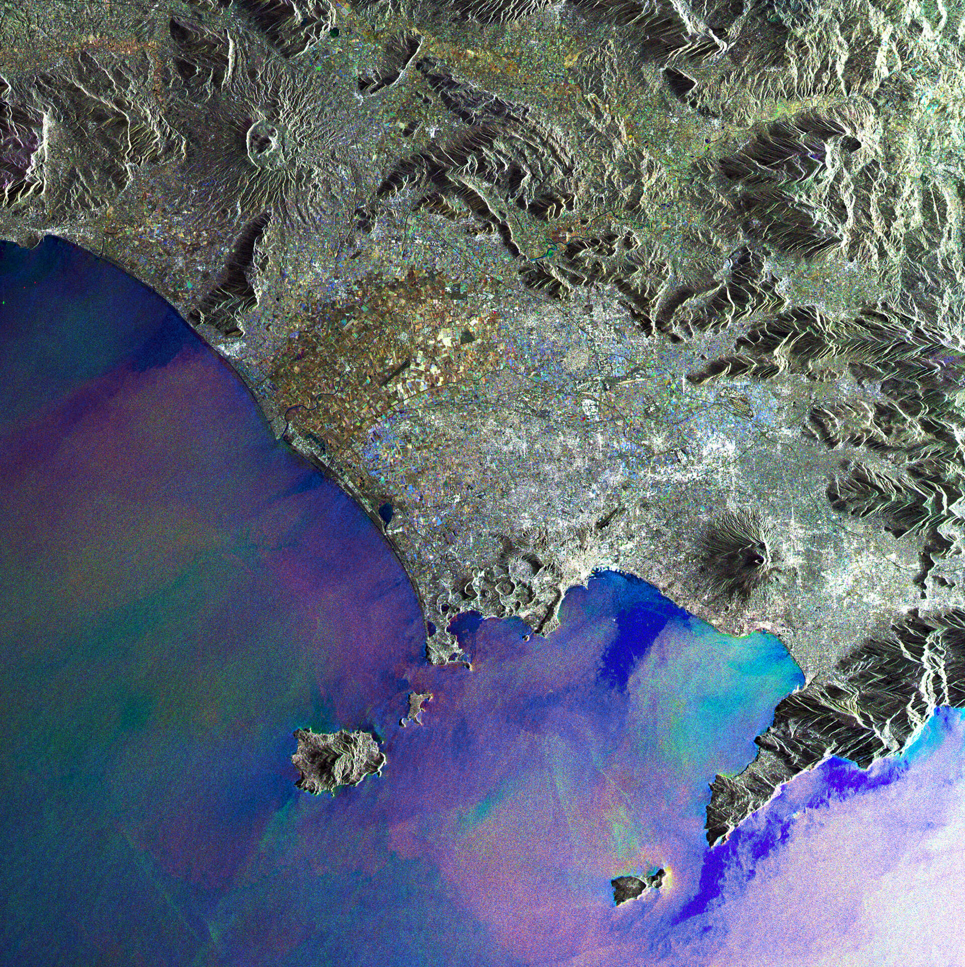
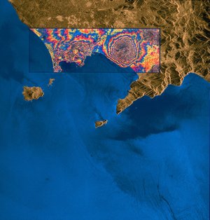
Bay of Naples
This Envisat Advanced Synthetic Aperture Radar (ASAR) composite image shows the Bay of Naples off the west coast of Italy. The bay is lined to the south by the Sorrento Peninsula – where the world-famous Amalfi coast runs along its southern edge. Just beyond the tip of the peninsula lies the beautiful island of Capri. The islands of Ischia, renowned for its thermal springs, and Procida can be seen to the top of the bay.
The image clearly displays the signs of volcanism in this region. Formed as a result of the collision between the African and Eurasian tectonic plates, Mount Vesuvius is featured just inland from the bay overlooking the city of Naples. This volcano has erupted many times, most notably in 79 AD when the cataclysmic eruption buried the surrounding area with up to 30 m of ash. The towns of Pompeii and Herculaneum were excavated last century, providing a snapshot of what Roman life was like almost 2000 years ago.
The region around this volcano is home to more than three million people and with the last eruption occurring in 1944, it is intensively monitored for signs of unrest.
Further signs of volcanism can be seen at the western end of the bay where the Phlegraean Fields lie. This complex structure, most of which is below sea level, is constantly on the move due to subsidence and uplift.
This image was created by combining three Envisat ASAR acquisitions taken over the same area. The colours in the image result from variations on the surface that occurred between acquisitions.