About ESA
The European Space Agency (ESA) is Europe’s gateway to space. Its mission is to shape the development of Europe’s space capability and ensure that investment in space continues to deliver benefits to the citizens of Europe and the world.
Highlights


Latest


Space in Member States
Find out more about space activities in our 23 Member States, and understand how ESA works together with their national agencies, institutions and organisations.
 Germany
 Austria
 Belgium
 Denmark
 Spain
Spain
 Estonia
 Finland
 France
 Greece
 Hungary
 Ireland
 Italy
Italy
 Luxembourg
 Norway
 The Netherlands
 Poland
 Portugal
 Czechia
 Romania
 United Kingdom
 Slovenia
 Sweden
 Switzerland
Science & Exploration
Exploring our Solar System and unlocking the secrets of the Universe
Go to topicAstronauts


Latest


Enabling & Support
Making space accessible and developing the technologies for the future
Go to topicLatest


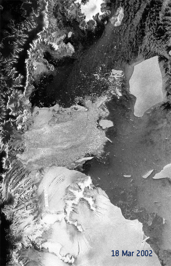
Larsen B: 1992-2002
This image of the Larsen B ice shelf is one of the first photos taken by Envisat on 18 March 2002. Prior to Envisat’s launch, ERS-1 and -2 had been monitoring changes in the region. Together with ERS data, this image (orbit 250) documents the 100-km retreat of the Larsen B ice shelf. Today, Envisat's radar continues to make regular, all-weather observations to enable detailed studies of the extent, surface motion and surface melt of all the ice shelves around Antarctica.