About ESA
The European Space Agency (ESA) is Europe’s gateway to space. Its mission is to shape the development of Europe’s space capability and ensure that investment in space continues to deliver benefits to the citizens of Europe and the world.
Highlights


Latest


Space in Member States
Find out more about space activities in our 23 Member States, and understand how ESA works together with their national agencies, institutions and organisations.
 Germany
 Austria
 Belgium
 Denmark
 Spain
Spain
 Estonia
 Finland
 France
 Greece
 Hungary
 Ireland
 Italy
Italy
 Luxembourg
 Norway
 The Netherlands
 Poland
 Portugal
 Czechia
 Romania
 United Kingdom
 Slovenia
 Sweden
 Switzerland
Science & Exploration
Exploring our Solar System and unlocking the secrets of the Universe
Go to topicAstronauts


Latest


Enabling & Support
Making space accessible and developing the technologies for the future
Go to topicLatest


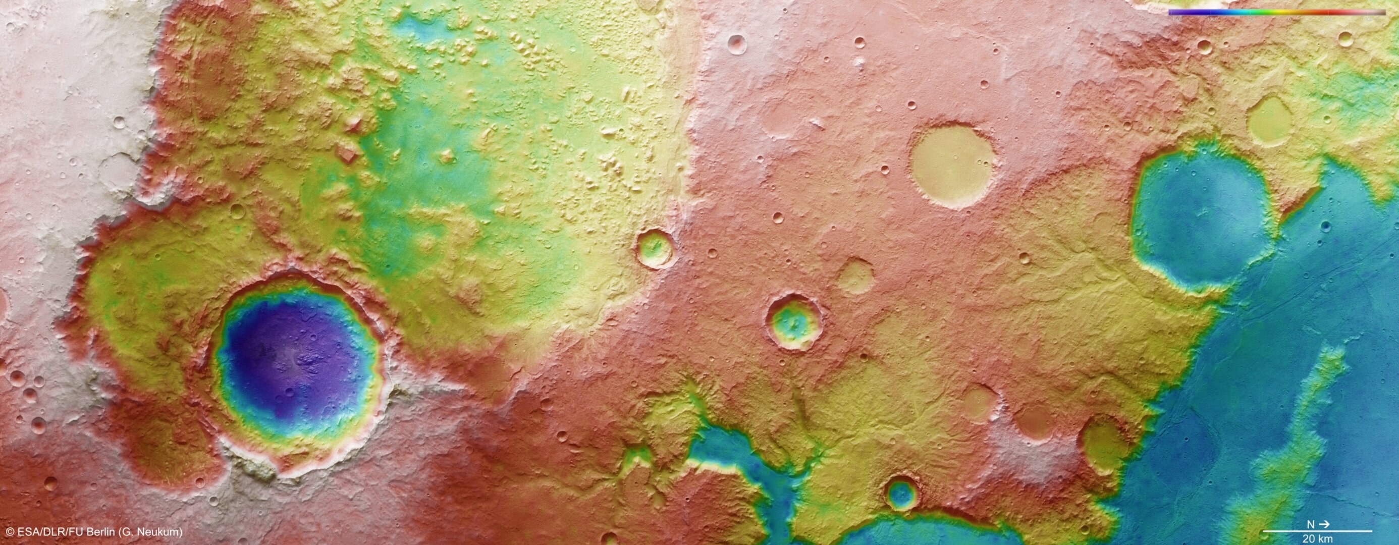
Amenthes Planum topography
This colour-coded overhead view is based on an ESA Mars Express High-Resolution Stereo Camera digital terrain model of the region southeast of Amenthes Planum and north of Hesperia Planum, from which the topography of the landscape can be derived. Centred at around 3°S and 109°E, the image has a ground resolution of about 22 m per pixel. The image was taken during revolution 11497 on 13 January 2013. The colour coding emphasises the superposed craters on the large 100 km-wide crater to the left (south) of the image. Also more clearly seen are the various mesa and buttes within the larger 100 km crater. At the bottom of the image is a small river valley that feeds into Palos crater, which may once have hosted a lake.