About ESA
The European Space Agency (ESA) is Europe’s gateway to space. Its mission is to shape the development of Europe’s space capability and ensure that investment in space continues to deliver benefits to the citizens of Europe and the world.
Highlights


Latest


Space in Member States
Find out more about space activities in our 23 Member States, and understand how ESA works together with their national agencies, institutions and organisations.
 Germany
 Austria
 Belgium
 Denmark
 Spain
Spain
 Estonia
 Finland
 France
 Greece
 Hungary
 Ireland
 Italy
Italy
 Luxembourg
 Norway
 The Netherlands
 Poland
 Portugal
 Czechia
 Romania
 United Kingdom
 Slovenia
 Sweden
 Switzerland
Science & Exploration
Exploring our Solar System and unlocking the secrets of the Universe
Go to topicAstronauts


Latest


Enabling & Support
Making space accessible and developing the technologies for the future
Go to topicLatest


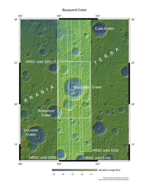
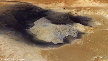
Becquerel Crater topography
This colour-coded topography map shows the relative heights and depths of features in and around Becquerel crater. White and red are the highest terrains, while blue and purple are the deepest, such as inside large impact craters. A decrease in overall elevation is seen towards the north (right) side of the image; this region occupies the transition zone between the southern highlands and the northern lowlands of Mars.
This region of Mars was imaged by the High Resolution Stereo Camera on ESA’s Mars Express, with an average ground resolution of 17 m per pixel. The image centre lies at about 22°N/352°E; North is to the right. The individual images were taken on 22 July 2006 (orbit 3253), and 26 February, 2 and 7 March 2008, corresponding to orbits 5332, 5350, and 5368, respectively.