About ESA
The European Space Agency (ESA) is Europe’s gateway to space. Its mission is to shape the development of Europe’s space capability and ensure that investment in space continues to deliver benefits to the citizens of Europe and the world.
Highlights


Latest


Space in Member States
Find out more about space activities in our 23 Member States, and understand how ESA works together with their national agencies, institutions and organisations.
 Germany
 Austria
 Belgium
 Denmark
 Spain
Spain
 Estonia
 Finland
 France
 Greece
 Hungary
 Ireland
 Italy
Italy
 Luxembourg
 Norway
 The Netherlands
 Poland
 Portugal
 Czechia
 Romania
 United Kingdom
 Slovenia
 Sweden
 Switzerland
Science & Exploration
Exploring our Solar System and unlocking the secrets of the Universe
Go to topicAstronauts


Latest


Enabling & Support
Making space accessible and developing the technologies for the future
Go to topicLatest


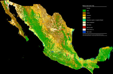
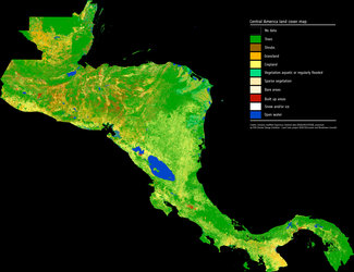
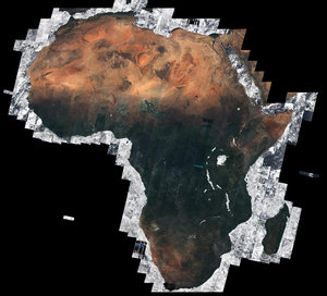
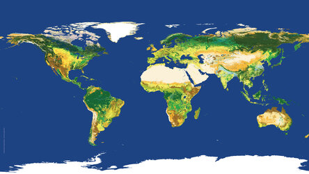
Land cover 2010
This global land-cover map was created using data from the Envisat mission for the 2010 epoch (2008–12).
This is the most recent data product from the Climate Change Initiative (CCI) Land Cover team led by the Université catholique de Louvain, showing 22 different types of global land cover classes, plus 14 regional land cover classes.
Following the GCOS Implementation Plan, the purpose of the CCI Land Cover project is to make the best use of available satellite sensor data to provide an accurate land-cover classification that can serve the climate modelling community. The maps propose a legend based on the FAO/UNEP Land Cover Classification System, in order to be compatible with previous products.
The land-cover maps are currently under validation by regional experts, coordinated by the European Commission’s Joint Research Centre.