About ESA
The European Space Agency (ESA) is Europe’s gateway to space. Its mission is to shape the development of Europe’s space capability and ensure that investment in space continues to deliver benefits to the citizens of Europe and the world.
Highlights


Latest


Space in Member States
Find out more about space activities in our 23 Member States, and understand how ESA works together with their national agencies, institutions and organisations.
 Germany
 Austria
 Belgium
 Denmark
 Spain
Spain
 Estonia
 Finland
 France
 Greece
 Hungary
 Ireland
 Italy
Italy
 Luxembourg
 Norway
 The Netherlands
 Poland
 Portugal
 Czechia
 Romania
 United Kingdom
 Slovenia
 Sweden
 Switzerland
Science & Exploration
Exploring our Solar System and unlocking the secrets of the Universe
Go to topicAstronauts


Latest


Enabling & Support
Making space accessible and developing the technologies for the future
Go to topicLatest


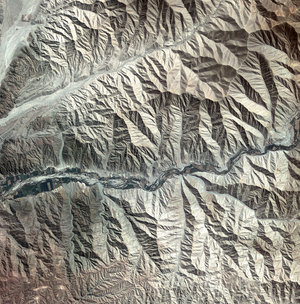
Quelccaya ice cap, Peru
This image features Peru’s Quelccaya ice cap, the largest in the Tropics.
Resting high up in the Cordillera Oriental of the Peruvian Andes, the ice cap has been shrinking due to rising temperatures in the region, losing over 20% of its area since the 1970s.
Downstream communities rely on this water source for drinking and electricity in this dry region, but some estimates show that the ice cap will vanish in a matter of decades, draining the water supply for millions of people.
In the far upper-left corner of the image, we can see the Qori Kalis Glacier, the ice cap’s main outlet. This glacier is retreating – and this retreat has accelerated in recent years – losing about 50% of its total length since the 1960s.
As a result of the glacier’s melting, a lake began to form in late 1980s and has grown over the years.
Other smaller lakes have also formed around the ice cap. Meltwater lakes are generally lighter in colour through the presence of fine particles produced by the grinding of the ice over bedrock – called ‘rock flour’. When this ‘flour’ turns the water white or cloudy, it is referred to as ‘glacial milk’.
The false-colour of this image makes vegetation appear bright red, and we can clearly see how vegetation grows mainly in the valleys and along the paths of water runoff.
This image, also featured on the Earth from Space video programme, was acquired on 29 June 2009 by the Korea Aerospace Research Institute’s Kompsat-2 satellite.