Accept all cookies Accept only essential cookies See our Cookie Notice

About ESA
The European Space Agency (ESA) is Europe’s gateway to space. Its mission is to shape the development of Europe’s space capability and ensure that investment in space continues to deliver benefits to the citizens of Europe and the world.
Highlights
ESA - United space in Europe
This is ESA ESA facts Member States & Cooperating States Funding Director General Top management For Member State Delegations European vision European Space Policy ESA & EU Space Councils Responsibility & Sustainability Annual Report Calendar of meetings Corporate newsEstablishments & sites
ESA Headquarters ESA ESTEC ESA ESOC ESA ESRIN ESA EAC ESA ESAC Europe's Spaceport ESA ESEC ESA ECSAT Brussels Office Washington OfficeWorking with ESA
Business with ESA ESA Commercialisation Gateway Law at ESA Careers Cyber resilience at ESA IT at ESA Newsroom Partnerships Merchandising Licence Education Open Space Innovation Platform Integrity and Reporting Administrative Tribunal Health and SafetyMore about ESA
History ESA Historical Archives Exhibitions Publications Art & Culture ESA Merchandise Kids Diversity ESA Brand Centre ESA ChampionsLatest
Space in Member States
Find out more about space activities in our 23 Member States, and understand how ESA works together with their national agencies, institutions and organisations.
Science & Exploration
Exploring our Solar System and unlocking the secrets of the Universe
Go to topicAstronauts
Missions
Juice Euclid Webb Solar Orbiter BepiColombo Gaia ExoMars Cheops Exoplanet missions More missionsActivities
International Space Station Orion service module Gateway Concordia Caves & Pangaea BenefitsLatest
Space Safety
Protecting life and infrastructure on Earth and in orbit
Go to topicAsteroids
Asteroids and Planetary Defence Asteroid danger explained Flyeye telescope: asteroid detection Hera mission: asteroid deflection Near-Earth Object Coordination CentreSpace junk
About space debris Space debris by the numbers Space Environment Report In space refuelling, refurbishing and removingSafety from space
Clean Space ecodesign Zero Debris Technologies Space for Earth Supporting Sustainable DevelopmentLatest
Applications
Using space to benefit citizens and meet future challenges on Earth
Go to topicObserving the Earth
Observing the Earth Future EO Copernicus Meteorology Space for our climate Satellite missionsCommercialisation
ESA Commercialisation Gateway Open Space Innovation Platform Business Incubation ESA Space SolutionsLatest
Enabling & Support
Making space accessible and developing the technologies for the future
Go to topicBuilding missions
Space Engineering and Technology Test centre Laboratories Concurrent Design Facility Preparing for the future Shaping the Future Discovery and Preparation Advanced Concepts TeamSpace transportation
Space Transportation Ariane Vega Space Rider Future space transportation Boost! Europe's Spaceport Launches from Europe's Spaceport from 2012Latest

Tonga
Thank you for liking
You have already liked this page, you can only like it once!
The island of Tongatapu and the nearby smaller islands – all part of the Kingdom of Tonga archipelago in the southern Pacific Ocean – are pictured in this Sentinel-2A image from 23 May.
Tonga’s population is spread across 36 of Tonga’s 169 islands, but about 70% live on this main island. The capital, Nukuʻalofa, sits on the island’s north coast and along the Fanga’uta Lagoon. The lagoon’s mangroves provide an important breeding ground for fish and birds.
Built on limestone, the island has fertile soil of volcanic ash from neighbouring volcanoes, and we can see how agricultural structures cover most of the island. Crops include root crops such as sweet potato and cassava, as well as coconuts, bananas and coffee beans.
North of the island we can see many coral reefs. Although not part of its original mission objectives, scientists are experimenting with Sentinel-2 to monitor corals and detect coral bleaching – a consequence of higher water temperatures.
Bleaching happens when algae living in the corals’ tissues, which capture the Sun’s energy and are essential to coral survival, are expelled owing to the higher temperature.
The whitening coral may die, with subsequent effects on the reef ecosystem, and thus fisheries, regional tourism and coastal protection.
The recent El Niño weather phenomenon has caused increased bleaching across the world’s corals, and scientists are finding Sentinel-2’s coverage helpful in monitoring this at reef-wide scales.
This image is also featured on the Earth from Space video programme.
-
CREDIT
Contains modified Copernicus Sentinel data (2016), processed by ESA -
LICENCE
CC BY-SA 3.0 IGO or ESA Standard Licence
(content can be used under either licence)

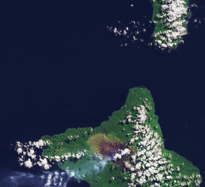
Ambrym, South Pacific Ocean

Henderson Island

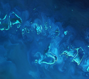
Great Barrier Reef

Earth from Space: Tonga


 Germany
 Austria
 Belgium
 Denmark
 Spain
Spain
 Estonia
 Finland
 France
 Greece
 Hungary
 Ireland
 Italy
Italy
 Luxembourg
 Norway
 The Netherlands
 Poland
 Portugal
 Czechia
 Romania
 United Kingdom
 Slovenia
 Sweden
 Switzerland


