Accept all cookies Accept only essential cookies See our Cookie Notice

About ESA
The European Space Agency (ESA) is Europe’s gateway to space. Its mission is to shape the development of Europe’s space capability and ensure that investment in space continues to deliver benefits to the citizens of Europe and the world.
Highlights
ESA - United space in Europe
This is ESA ESA facts Member States & Cooperating States Funding Director General Top management For Member State Delegations European vision European Space Policy ESA & EU Space Councils Responsibility & Sustainability Annual Report Calendar of meetings Corporate newsEstablishments & sites
ESA Headquarters ESA ESTEC ESA ESOC ESA ESRIN ESA EAC ESA ESAC Europe's Spaceport ESA ESEC ESA ECSAT Brussels Office Washington OfficeWorking with ESA
Business with ESA ESA Commercialisation Gateway Law at ESA Careers Cyber resilience at ESA IT at ESA Newsroom Partnerships Merchandising Licence Education Open Space Innovation Platform Integrity and Reporting Administrative Tribunal Health and SafetyMore about ESA
History ESA Historical Archives Exhibitions Publications Art & Culture ESA Merchandise Kids Diversity ESA Brand Centre ESA ChampionsLatest
Space in Member States
Find out more about space activities in our 23 Member States, and understand how ESA works together with their national agencies, institutions and organisations.
Science & Exploration
Exploring our Solar System and unlocking the secrets of the Universe
Go to topicAstronauts
Missions
Juice Euclid Webb Solar Orbiter BepiColombo Gaia ExoMars Cheops Exoplanet missions More missionsActivities
International Space Station Orion service module Gateway Concordia Caves & Pangaea BenefitsLatest
Space Safety
Protecting life and infrastructure on Earth and in orbit
Go to topicAsteroids
Asteroids and Planetary Defence Asteroid danger explained Flyeye telescope: asteroid detection Hera mission: asteroid deflection Near-Earth Object Coordination CentreSpace junk
About space debris Space debris by the numbers Space Environment Report In space refuelling, refurbishing and removingSafety from space
Clean Space ecodesign Zero Debris Technologies Space for Earth Supporting Sustainable DevelopmentApplications
Using space to benefit citizens and meet future challenges on Earth
Go to topicObserving the Earth
Observing the Earth Future EO Copernicus Meteorology Space for our climate Satellite missionsCommercialisation
ESA Commercialisation Gateway Open Space Innovation Platform Business Incubation ESA Space SolutionsLatest
Enabling & Support
Making space accessible and developing the technologies for the future
Go to topicBuilding missions
Space Engineering and Technology Test centre Laboratories Concurrent Design Facility Preparing for the future Shaping the Future Discovery and Preparation Advanced Concepts TeamSpace transportation
Space Transportation Ariane Vega Space Rider Future space transportation Boost! Europe's Spaceport Launches from Europe's Spaceport from 2012Latest

China’s Tian Shan mountains
Thank you for liking
You have already liked this page, you can only like it once!
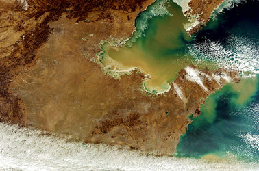
Sentinel-2A takes us over northwestern China near the border with Kazakhstan and Kyrgyzstan in this false-colour image.
The mountains pictured are part of the Tian Shan range, which stretches about 2800 km across this border region, making it one of the longest mountain ranges in Central Asia.
The glaciers of Tian Shan have lost about a quarter of their ice mass since the 1960s, and scientists estimate that half of the remaining glaciers will have melted by 2050. Glaciers are a key indicator of climate change, and their melting poses threats to communities living downstream.
We know well that snow and clouds are both white – had this image been in true colour, we wouldn’t be able to differentiate between the two. But Sentinel-2’s imager can view the area in different parts of the spectrum, and can separate clouds from snow. In this image, clouds are white while snow appears blue. This is particularly important for mapping snow cover.
A few clouds can been seen over the mountains near the centre of the image, with thicker cloud cover in the valleys to the north.
The orange area on the right side of the image is part of the Bayanbulak Basin, a large grassland area of about 24 000 sq km. Although not pictured, the basin also hosts an important wetland and China’s very own ‘Swan lake’ – the highest-altitude breeding ground for swans in the world.
This area of the Tian Shan mountains in China's Xinjiang Region became a UNESCO World Heritage Site in 2013.
This image from the Copernicus Sentinel-2A satellite was captured on 18 November 2016, and is also featured on the Earth from Space video programme.
-
CREDIT
contains modified Copernicus Sentinel data (2016), processed by ESA -
LICENCE
CC BY-SA 3.0 IGO or ESA Standard Licence
(content can be used under either licence)


 Germany
 Austria
 Belgium
 Denmark
 Spain
Spain
 Estonia
 Finland
 France
 Greece
 Hungary
 Ireland
 Italy
Italy
 Luxembourg
 Norway
 The Netherlands
 Poland
 Portugal
 Czechia
 Romania
 United Kingdom
 Slovenia
 Sweden
 Switzerland


