
Applications
Nitrogen dioxide from ships
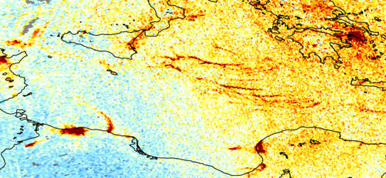
Emissions measured from space can show when certain patterns of behaviour change – and so can be useful for highlighting the humanitarian impact caused by a particular issue. For example, the Arabian Peninsula is surrounded by important international shipping lanes, dominated by container ships and oil tankers. However, since 2008 ships have been coming under attack from pirates and have been forced to change their routes. These route shifts have been reflected in current satellite data measuring pollutants. This image of nitrogen dioxide emissions in 2010 represents ship tracks around the Gulf of Aden while ships moved away from the Somalian coast for fear of attack.


