About ESA
The European Space Agency (ESA) is Europe’s gateway to space. Its mission is to shape the development of Europe’s space capability and ensure that investment in space continues to deliver benefits to the citizens of Europe and the world.
Highlights


Latest


Space in Member States
Find out more about space activities in our 23 Member States, and understand how ESA works together with their national agencies, institutions and organisations.
 Germany
 Austria
 Belgium
 Denmark
 Spain
Spain
 Estonia
 Finland
 France
 Greece
 Hungary
 Ireland
 Italy
Italy
 Luxembourg
 Norway
 The Netherlands
 Poland
 Portugal
 Czechia
 Romania
 United Kingdom
 Slovenia
 Sweden
 Switzerland
Science & Exploration
Exploring our Solar System and unlocking the secrets of the Universe
Go to topicAstronauts


Latest


Enabling & Support
Making space accessible and developing the technologies for the future
Go to topicLatest


Winners
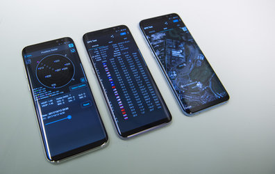
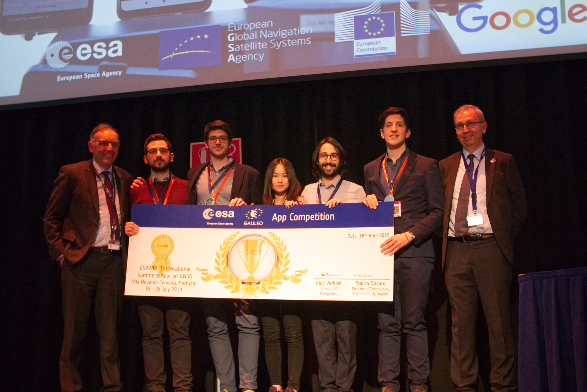
The multinational ‘O ThiSaVRoS’ team – named after the Greek word for treasure – developed the ‘GNSS Android-based Dual Frequency Iono-estimating Precise Point Positioning’ or GADIP 3 app, winning the ESA-EC-GSA Galileo smartphone app competition 2019. The five-person team hail from China, France, Greek, Italy and Spain, studying at Portugal’s Técnico Lisboa, TU Delft in the Netherlands, Germany’s Leibniz University Hannover and the Universities of Bath and Nottingham in the UK. They worked remotely to develop and test the app over the previous six months. The competition's final presentation took place on Thursday 18 April. The team are seen flanked by Marco Falcone, heading Galileo System Office, to the left, and Riccardo de Gaudenzi, head of ESA's Electrical Department, right.
Europe’s students and young researchers were challenged to design a smartphone app to take advantage of Galileo’s dual-frequency signal. Run by ESA in collaboration with the European Global Navigation Satellite Systems Agency – GSA – plus the European Commission with the support of Google, a total of five teams made it to the final, which took place at ESA’s ESTEC technical heart in the Netherlands.
The app allows users to perform reliable positioning fixes in real time – selecting which constellations to employ and a choice of single or dual frequency signals – while advanced users can modify the way the positioning is performed, and log all available data for follow-up analysis.