About ESA
The European Space Agency (ESA) is Europe’s gateway to space. Its mission is to shape the development of Europe’s space capability and ensure that investment in space continues to deliver benefits to the citizens of Europe and the world.
Highlights


Latest


Space in Member States
Find out more about space activities in our 23 Member States, and understand how ESA works together with their national agencies, institutions and organisations.
 Germany
 Austria
 Belgium
 Denmark
 Spain
Spain
 Estonia
 Finland
 France
 Greece
 Hungary
 Ireland
 Italy
Italy
 Luxembourg
 Norway
 The Netherlands
 Poland
 Portugal
 Czechia
 Romania
 United Kingdom
 Slovenia
 Sweden
 Switzerland
Science & Exploration
Exploring our Solar System and unlocking the secrets of the Universe
Go to topicAstronauts


Latest


Enabling & Support
Making space accessible and developing the technologies for the future
Go to topicLatest


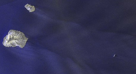
Mapped by Sentinel-1 for Vendée Globe safety
After almost three months at sea, competitors of the Vendée Globe sailing race are now nearing the finishing point back in France, but while they were near the treacherous iceberg-infested waters of the Southern Ocean they remained relatively safe thanks to satellite observations. Read: Copernicus satellites keep eyes on icebergs for Vendée Globe
To ensure their safety, CLS, a subsidiary of the French CNES space agency, and CNP used information from satellites to detect and monitor icebergs. This information comes from satellites carrying altimeters, as well as those carrying synthetic aperture radar (SAR) such as Copernicus Sentinel-1. Satellites are the only way of detecting and monitoring icebergs effectively in the remote Southern Oceans.
Before the race started, this satellite information allowed CLS to establish an initial exclusion zone around Antarctica to keep sailors away from icebergs. Remarkably, they updated the zone no less than five times as the icy waters changed. These updates were provided to the Vendée Globe race organisers, who then communicated it to the skippers.
The image shows the main features of the clusters of icebergs detected with altimetry (coloured dots), Sentinel-1 wave mode (large cyan snowflakes) and Sentinel-1 synthetic aperture radar imagery (small blue snowflakes). These detections are plotted on a sea-surface temperature map. The image shows the extensive use of Sentinel-1 (black frames) during the Vendée Globe 2020–21, as well as the final version of the Antarctic Exclusion Zone (white line).
Read full story: Copernicus Sentinel-1 guides Vendée Globe sailors to safety