Agency
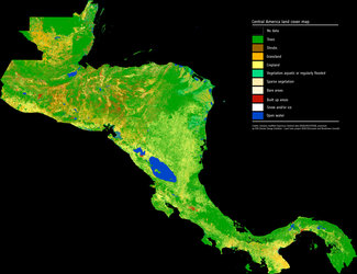
Land cover types in Starling
Presenting Starling, the interactive digital platform using satellite images and in-situ field knowledge to monitor land cover change and forest cover disturbance in near real-time.
"In addition to an imagery layer from Airbus' SPOT satellites, Starling provides a 20-year time series of land cover basemaps and land cover change analytics, using images from the Sentinel-2 and Landsat satellites," explains Pauline Sol-Wagner, who works on agricultural business development at Airbus. "These allow monitoring of the evolution of land cover, and include commodity-specific production data."
Find out more in our dedicated article.