About ESA
The European Space Agency (ESA) is Europe’s gateway to space. Its mission is to shape the development of Europe’s space capability and ensure that investment in space continues to deliver benefits to the citizens of Europe and the world.
Highlights


Latest


Space in Member States
Find out more about space activities in our 23 Member States, and understand how ESA works together with their national agencies, institutions and organisations.
 Germany
 Austria
 Belgium
 Denmark
 Spain
Spain
 Estonia
 Finland
 France
 Greece
 Hungary
 Ireland
 Italy
Italy
 Luxembourg
 Norway
 The Netherlands
 Poland
 Portugal
 Czechia
 Romania
 United Kingdom
 Slovenia
 Sweden
 Switzerland
Science & Exploration
Exploring our Solar System and unlocking the secrets of the Universe
Go to topicAstronauts


Latest


Enabling & Support
Making space accessible and developing the technologies for the future
Go to topicLatest


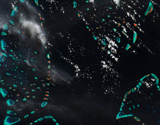
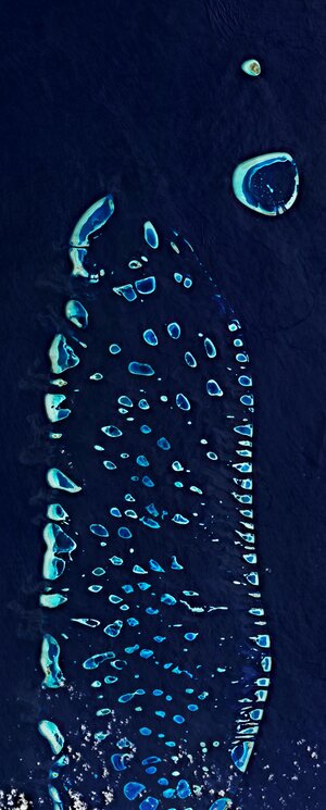
Malé, the Maldives
The Copernicus Sentinel-2 mission takes us over Malé – the capital and most populous city in the Republic of Maldives.
The Republic of Maldives consist of a chain of around 1200 small coral islands that are grouped into clusters of atolls – scattered across 90 000 sq km of ocean. A number of these little islands can be seen in the image, with the turquoise colours depicting clear, shallow waters dotted by coral reefs which contrasts with the dark colours of the Indian Ocean.
Malé, located at the southern edge of the North Malé Atoll, can be easily spotted in the right of the image. The island is small enough to walk around in approximately one hour, with most sights concentrated on its northern shore. Malé is both a trade and tourist centre, connected with Sri Lanka and India by steamship lines, with several vessels visible in the image.
With a population of more than 200 000 and an area of around eight sq km, Malé is one of the most densely populated cities in the world with the city covering almost the entire island.
With more than 80% of the Maldives’ land standing less than one metre above average sea level, the Maldives has the lowest terrain of any country in the world. This makes the archipelago particularly vulnerable to sea-level rise.
In response to this rising threat, the Maldives is working on enhancing the resilience of the country’s islands, which includes constructing the artificial island of Hulhumale – visible northeast of the airport island of Hulhulé.
The island has been constructed by pumping sand from the seafloor onto a submerged coral platform, that rises around 2 m above sea level. The reclaimed land provides some much-needed space, and will also help meet the industrial and commercial development of the Malé region.
Satellite data have shown that the global ocean has risen, on average, 3 mm a year over the last 25 years. Warming ocean waters, melting glaciers and diminishing ice sheets is making rising sea levels a real threat for low-lying islands such as the Maldives.
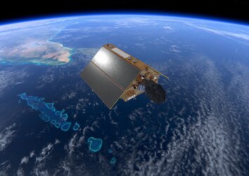
Following liftoff in November 2020, the Copernicus Sentinel-6 Michael Freilich satellite, the most advanced mission dedicated to measuring sea-level rise, is now fully operational – meaning that its data are available to climate researchers, ocean-weather forecasts and other data users. Learn more about the Sentinel-6 mission here.
This image, also featured on the Earth from Space video programme, was captured by the Copernicus Sentinel-2 mission – a two-satellite mission to supply the coverage and data delivery needed for Europe’s Copernicus programme.