Accept all cookies Accept only essential cookies See our Cookie Notice

About ESA
The European Space Agency (ESA) is Europe’s gateway to space. Its mission is to shape the development of Europe’s space capability and ensure that investment in space continues to deliver benefits to the citizens of Europe and the world.
Highlights
ESA - United space in Europe
This is ESA ESA facts Member States & Cooperating States Funding Director General Top management For Member State Delegations European vision European Space Policy ESA & EU Space Councils Responsibility & Sustainability Annual Report Calendar of meetings Corporate newsEstablishments & sites
ESA Headquarters ESA ESTEC ESA ESOC ESA ESRIN ESA EAC ESA ESAC Europe's Spaceport ESA ESEC ESA ECSAT Brussels Office Washington OfficeWorking with ESA
Business with ESA ESA Commercialisation Gateway Law at ESA Careers Cyber resilience at ESA IT at ESA Newsroom Partnerships Merchandising Licence Education Open Space Innovation Platform Integrity and Reporting Administrative Tribunal Health and SafetyMore about ESA
History ESA Historical Archives Exhibitions Publications Art & Culture ESA Merchandise Kids Diversity ESA Brand Centre ESA ChampionsLatest
Space in Member States
Find out more about space activities in our 23 Member States, and understand how ESA works together with their national agencies, institutions and organisations.
Science & Exploration
Exploring our Solar System and unlocking the secrets of the Universe
Go to topicAstronauts
Missions
Juice Euclid Webb Solar Orbiter BepiColombo Gaia ExoMars Cheops Exoplanet missions More missionsActivities
International Space Station Orion service module Gateway Concordia Caves & Pangaea BenefitsLatest
Space Safety
Protecting life and infrastructure on Earth and in orbit
Go to topicAsteroids
Asteroids and Planetary Defence Asteroid danger explained Flyeye telescope: asteroid detection Hera mission: asteroid deflection Near-Earth Object Coordination CentreSpace junk
About space debris Space debris by the numbers Space Environment Report In space refuelling, refurbishing and removingSafety from space
Clean Space ecodesign Zero Debris Technologies Space for Earth Supporting Sustainable DevelopmentLatest
Applications
Using space to benefit citizens and meet future challenges on Earth
Go to topicObserving the Earth
Observing the Earth Future EO Copernicus Meteorology Space for our climate Satellite missionsCommercialisation
ESA Commercialisation Gateway Open Space Innovation Platform Business Incubation ESA Space SolutionsLatest
Enabling & Support
Making space accessible and developing the technologies for the future
Go to topicBuilding missions
Space Engineering and Technology Test centre Laboratories Concurrent Design Facility Preparing for the future Shaping the Future Discovery and Preparation Advanced Concepts TeamSpace transportation
Space Transportation Ariane Vega Space Rider Future space transportation Boost! Europe's Spaceport Launches from Europe's Spaceport from 2012Latest
Kuala Lumpur, Malaysia
Thank you for liking
You have already liked this page, you can only like it once!
Kuala Lumpur, the capital city of Malaysia, is featured in this image captured by the Copernicus Sentinel-2 mission.
Zoom in to see this image at its full 10 m resolution or click on the circles to learn more about the features in it.
Located in west-central Malaysia, Kuala Lumpur is the country’s largest urban area and its cultural, commercial and transportation centre. The city lies in the hilly countryside of the Klang Valley and lies astride the confluence of the Kelang and Gombak rivers. Its name in Malay means ‘muddy estuary.’
The city’s commercial quarter, known as the Golden Triangle, is the site of the Petronas Twin Towers, the tallest twin towers in the world. Kuala Lumpur International Airport, one of the busiest airports in Asia, can be seen in the bottom of the image.
The Klang Valley is bordered by the Titiwangsa Mountains to the east, some minor ranges in the north and the Strait of Malacca in the west. Visible in the far left of the image, the Strait of Malacca is a narrow stretch of water between the Malay Peninsula and the Indonesian island of Sumatra. A main shipping channel between the Indian and Pacific oceans, it is one of the most important shipping lanes in the world. Port Klang, is the main gateway by sea into Malaysia and lies around 40 km southwest of Kuala Lumpur.
The Greater Kuala Lumpur area is around 2700 sq km and is an urban agglomeration of over seven million people – making it one of the fastest growing metropolitan regions in Southeast Asia. Like many other growing cities and areas in the world, the region is facing the daunting challenge of urban sprawl. This puts pressure on urban land in the city, but also on agricultural land in the periphery, as well as on other natural resources.
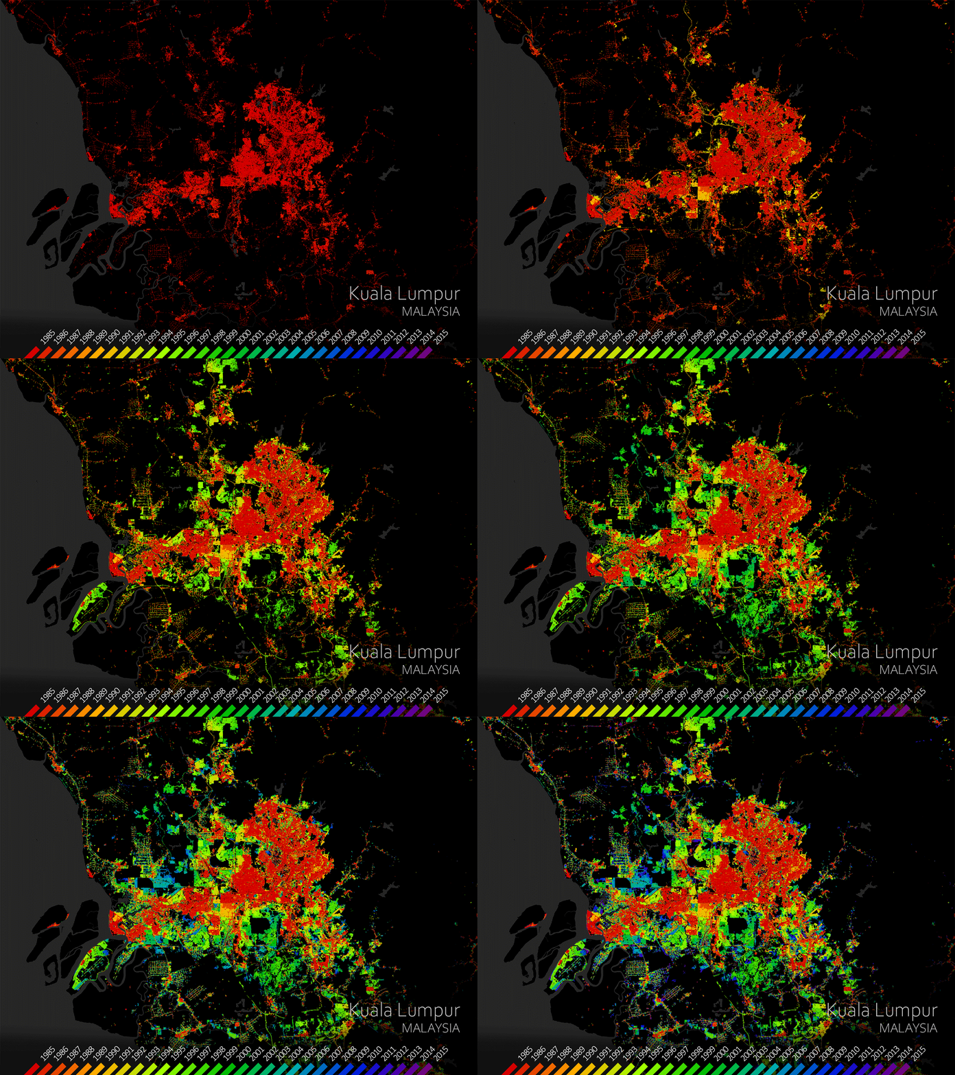
Urban areas are already home to 55% of the world’s population and that figure is expected to grow to 68% by 2050. In order to gain a better understanding of current trends in global urbanisation, ESA and the German Aerospace Center (DLR), in collaboration with the Google Earth Engine team, have jointly developed the World Settlement Footprint – the world’s most comprehensive dataset on human settlement.
The World Settlement Footprint Evolution has been generated by processing seven million images from the US Landsat satellite collected between 1985 and 2015. One of the animations illustrates the growth of Kuala Lumpur on a year-by-year basis, from 1985 to 2015.
This unprecedented collection of information on human settlement will not only advance our understanding of urbanisation on a global scale but will also become an asset for national statistical offices, local authorities, civil society and international organisations.
This image is also featured on the Earth from Space video programme.
-
CREDIT
contains modified Copernicus Sentinel data (2020), processed by ESA -
LICENCE
CC BY-SA 3.0 IGO or ESA Standard Licence
(content can be used under either licence)

Kuala Lumpur, Malaysia

Earth from Space: Kuala Lumpur, Malaysia

Kuala Lumpur, Malaysia

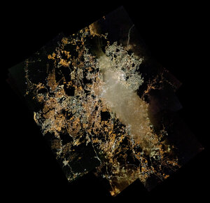
Kuala Lumpur mapped at night


 Germany
 Austria
 Belgium
 Denmark
 Spain
Spain
 Estonia
 Finland
 France
 Greece
 Hungary
 Ireland
 Italy
Italy
 Luxembourg
 Norway
 The Netherlands
 Poland
 Portugal
 Czechia
 Romania
 United Kingdom
 Slovenia
 Sweden
 Switzerland


