
About ESA
The European Space Agency (ESA) is Europe’s gateway to space. Its mission is to shape the development of Europe’s space capability and ensure that investment in space continues to deliver benefits to the citizens of Europe and the world.
Highlights


Latest


Space in Member States
Find out more about space activities in our 23 Member States, and understand how ESA works together with their national agencies, institutions and organisations.
 Germany
 Austria
 Belgium
 Denmark
 Spain
Spain
 Estonia
 Finland
 France
 Greece
 Hungary
 Ireland
 Italy
Italy
 Luxembourg
 Norway
 The Netherlands
 Poland
 Portugal
 Czechia
 Romania
 United Kingdom
 Slovenia
 Sweden
 Switzerland
Science & Exploration
Exploring our Solar System and unlocking the secrets of the Universe
Go to topicAstronauts


Latest


Enabling & Support
Making space accessible and developing the technologies for the future
Go to topicLatest


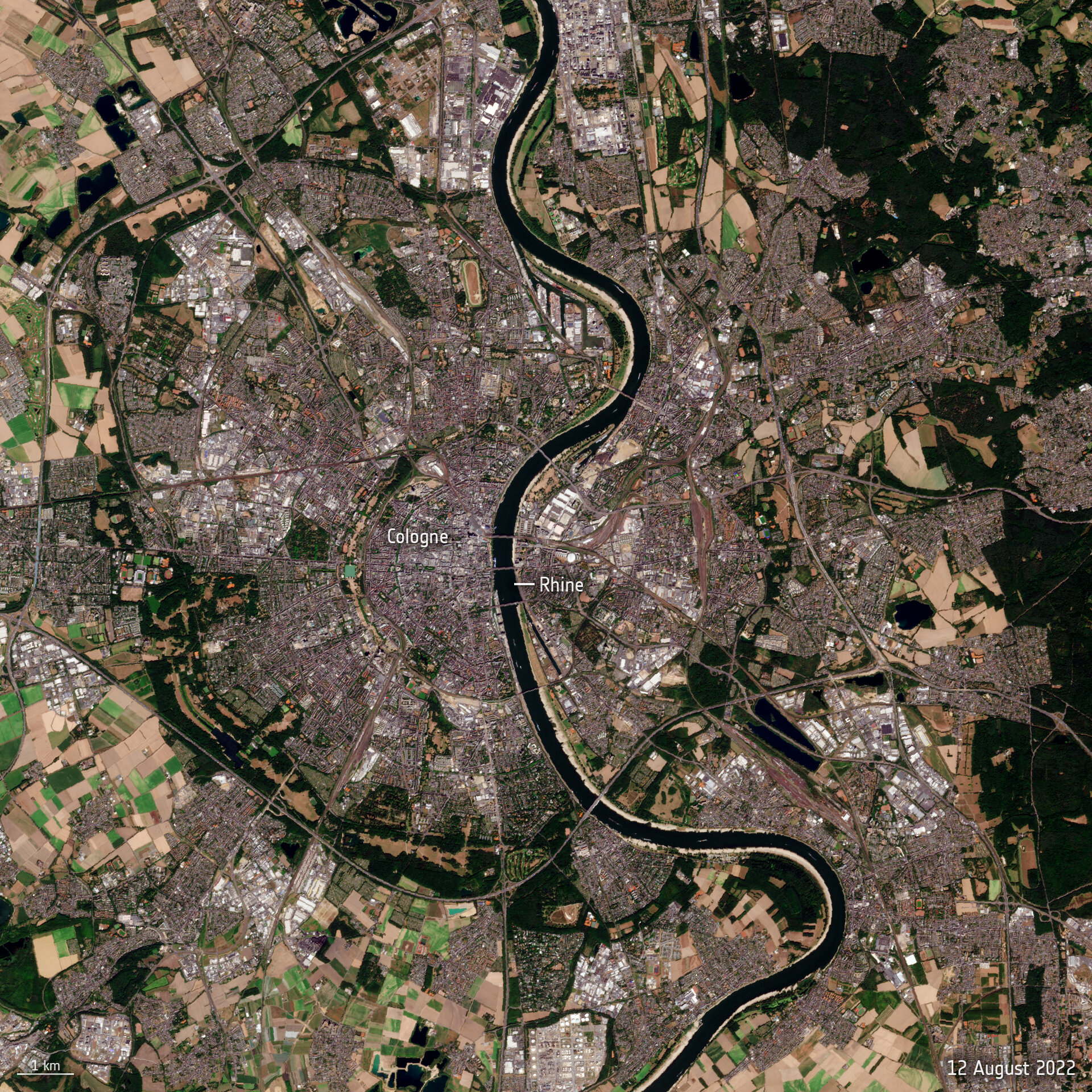
Rhine river runs dry
Water levels on the Rhine River, Europe’s second-largest river, have continued to drop owing to soaring temperatures and lack of rainfall, preventing many vessels from navigating through the waters at full capacity. The Copernicus Sentinel-2 mission captured part of the Rhine River near Cologne – showing the stark difference between August 2021 and August 2022.
Flowing from the Swiss Alps to the North Sea, the Rhine River is an important shipping route for many products from grains to chemicals to coal. When water levels drop, cargo vessels need to sail with reduced load, so they don’t run aground.
Water levels at the chokepoint of Kaub, near Frankfurt, fell to 32 cm in depth on Monday, down from 42 cm last week. Ships, however, need around 1.5 m to be able to sail fully loaded making it difficult for larger ships to navigate through the waters. Freight ships continue to sail, but only with around 25% to 35% of the ship’s capacity.
The low water levels are emerging earlier than usual, with the lowest water levels typically recorded in September or October. However, reduced temperatures and predicted rainfall forecasted for this week may offer relief to the Rhine.
The phenomenon facing the Rhine is common across much of Europe after an unusually hot and dry summer – causing wildfires and water shortages.
The Copernicus Sentinel-2 satellites capture high-resolution imagery that provide information about the conditions on Earth, such as plant life, soil and coastal areas. The mission consists of two satellites both of which carry an innovative multispectral imager – a camera that captures optical images over a range of wavelengths beyond visible light. For more information on the Sentinel-2 satellite, click here.


