About ESA
The European Space Agency (ESA) is Europe’s gateway to space. Its mission is to shape the development of Europe’s space capability and ensure that investment in space continues to deliver benefits to the citizens of Europe and the world.
Highlights


Latest


Space in Member States
Find out more about space activities in our 23 Member States, and understand how ESA works together with their national agencies, institutions and organisations.
 Germany
 Austria
 Belgium
 Denmark
 Spain
Spain
 Estonia
 Finland
 France
 Greece
 Hungary
 Ireland
 Italy
Italy
 Luxembourg
 Norway
 The Netherlands
 Poland
 Portugal
 Czechia
 Romania
 United Kingdom
 Slovenia
 Sweden
 Switzerland
Science & Exploration
Exploring our Solar System and unlocking the secrets of the Universe
Go to topicAstronauts


Latest


Enabling & Support
Making space accessible and developing the technologies for the future
Go to topicLatest


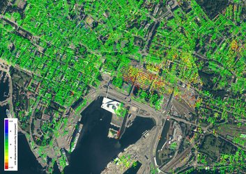
Earth from Space: Oslo, Norway
The Copernicus Sentinel-2 mission takes us over Oslo, Norway’s capital and largest city, and host of the 2023 Global Space Conference on Climate Change, taking place on 23–25 May.
Zoom in to explore this image at its full 10 m resolution or click on the circles to learn more.
In this false-colour image, Oslo can be seen in grey at the centre top, surrounded by vast dense forest visible in bright red.
Easily accessible from the city, the surrounding forest and hills are known as Oslomarka. It is a protected area, dedicated to nature, recreational activities and agriculture. The wider and most central part is Nordmarka, which offers many hiking trails in summer and skiing tracks in winter.
Oslo lies at the head of the inner Oslofjord, which, in the image, is dotted with ferries and cargo vessels. While the urban core of the city is on the mainland, Oslo also includes many islands within the fjord. These islands are popular holiday destinations, especially in summer.
Since this image was captured on 22 April 2023, the mountains northwest of Oslo are still dusted with snow. A number of water bodies, visible in various tones of blue and white throughout the image, appear to be frozen or covered by ice and snow.
In contrast, the waters of the Svelle and Øyeren lakes, on the right side of the image, appear in tones of green and beige. This is likely to be due to the presence of sediment in rivers draining into the lakes. Svelle and Øyeren are separated by the delta of the Glomma river, Norway’s longest, which flows from the northeast into the Øyeren lake and eventually enters Oslofjord further south.
False-colour images are used to reveal information that would otherwise be invisible to the human eye. Depending on the colour scheme chosen, different types of land cover can be detected. Copernicus Sentinel-2’s near-infrared channel was used to process this image which highlights vegetation in red.