
EarthCARE cloud profiling radar first image
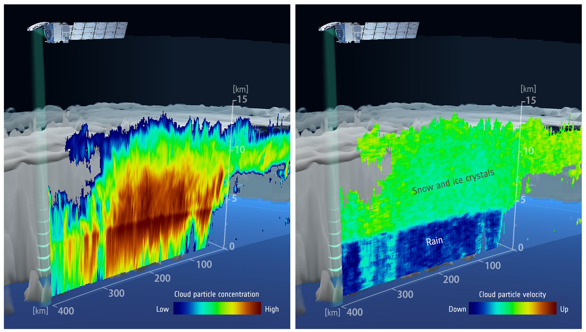
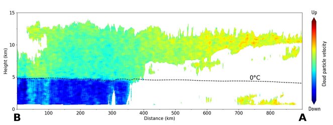
Launched on 29 May 2024, ESA’s EarthCARE satellite has returned the first image from its cloud profiling radar instrument. The image is displayed in two parts. On the left, the data unveils the vertically-resolved concentration of cloud particles measured as radar reflectivity. It is clear to see that the denser part of the cloud is in its centre. On the right, the top layer includes ice crystals and snowflakes, which are suspended in the atmosphere with little vertical motion. Both images show a clear boundary at an altitude of around 5 km, which is where the ice and snow, in the upper layer, melt, forming water droplets falling as rain.
The radar uses its Doppler velocity capability, a unique measurement from space, to derive the vertical speed and motion of the ice, snow and rain. This detailed information about the density, particle distribution and velocity within the cloud allows scientists to distinguish the cloud constituents and better understand its physics.
Conventionally, these data can only be obtained by cloud radar on the ground or on aircraft. These methods can only measure limited areas, but the cloud profiling radar aboard the EarthCARE satellite now allows cloud structure to be measured uniformly across of the entire planet.
Read full story: A first: inner secrets of clouds revealed from space


