Applications
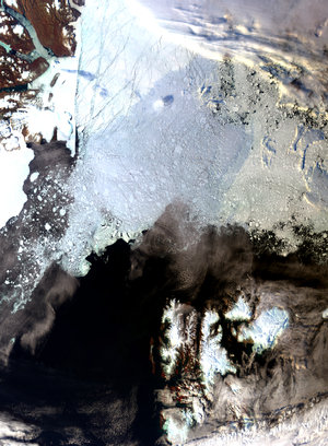
Svalbard, Norway, seen from Sentinel-1C
Less than a week after its launch, the Copernicus Sentinel-1C satellite has delivered its first radar images of Earth – offering a glimpse into its capabilities for environmental monitoring.
The first image, captured just 56 hours and 23 minutes after liftoff, features Svalbard, a remote Norwegian archipelago in the Arctic Ocean. Zoom in to explore this image at its full resolution.
This image demonstrates Sentinel-1C’s ability to monitor ice coverage and environmental changes in harsh and isolated regions. These capabilities are essential for understanding the effects of climate change on polar ecosystems and for enabling safer navigation in Arctic waters.
Read full story: Sentinel-1C captures first radar images


