Accept all cookies Accept only essential cookies See our Cookie Notice

About ESA
The European Space Agency (ESA) is Europe’s gateway to space. Its mission is to shape the development of Europe’s space capability and ensure that investment in space continues to deliver benefits to the citizens of Europe and the world.
Highlights
ESA - United space in Europe
This is ESA ESA facts Member States & Cooperating States Funding Director General Top management For Member State Delegations European vision European Space Policy ESA & EU Space Councils Responsibility & Sustainability Annual Report Calendar of meetings Corporate newsEstablishments & sites
ESA Headquarters ESA ESTEC ESA ESOC ESA ESRIN ESA EAC ESA ESAC Europe's Spaceport ESA ESEC ESA ECSAT Brussels Office Washington OfficeWorking with ESA
Business with ESA ESA Commercialisation Gateway Law at ESA Careers Cyber resilience at ESA IT at ESA Newsroom Partnerships Merchandising Licence Education Open Space Innovation Platform Integrity and Reporting Administrative Tribunal Health and SafetyMore about ESA
History ESA Historical Archives Exhibitions Publications Art & Culture ESA Merchandise Kids Diversity ESA Brand Centre ESA ChampionsLatest
Space in Member States
Find out more about space activities in our 23 Member States, and understand how ESA works together with their national agencies, institutions and organisations.
Science & Exploration
Exploring our Solar System and unlocking the secrets of the Universe
Go to topicAstronauts
Missions
Juice Euclid Webb Solar Orbiter BepiColombo Gaia ExoMars Cheops Exoplanet missions More missionsActivities
International Space Station Orion service module Gateway Concordia Caves & Pangaea BenefitsSpace Safety
Protecting life and infrastructure on Earth and in orbit
Go to topicAsteroids
Asteroids and Planetary Defence Asteroid danger explained Flyeye telescope: asteroid detection Hera mission: asteroid deflection Near-Earth Object Coordination CentreSpace junk
About space debris Space debris by the numbers Space Environment Report In space refuelling, refurbishing and removingSafety from space
Clean Space ecodesign Zero Debris Technologies Space for Earth Supporting Sustainable DevelopmentLatest
Applications
Using space to benefit citizens and meet future challenges on Earth
Go to topicObserving the Earth
Observing the Earth Future EO Copernicus Meteorology Space for our climate Satellite missionsCommercialisation
ESA Commercialisation Gateway Open Space Innovation Platform Business Incubation ESA Space SolutionsLatest
Enabling & Support
Making space accessible and developing the technologies for the future
Go to topicBuilding missions
Space Engineering and Technology Test centre Laboratories Concurrent Design Facility Preparing for the future Shaping the Future Discovery and Preparation Advanced Concepts TeamSpace transportation
Space Transportation Ariane Vega Space Rider Future space transportation Boost! Europe's Spaceport Launches from Europe's Spaceport from 2012Latest
STS-99 Post Flight Presentation
On 31 January 2000, the Space Shuttle Endeavour was launched on a mission to complete the most extensive topographic survey of the Earth's surface to date. The Shuttle Radar Topography Mission (SRTM) collected radar data, using a technique called Synthetic Aperture Radar (SAR) interferometry. This data will enable scientists to produce detailed three-dimensional models of 80% of the planet's surface. These will be the first 3D maps of developing countries and large areas of the Earth's sparsely populated desert and forest. Benefits in collecting this data will include improved forecasting of environmental conditions, increased navigational safety, help with urban planning and road construction.
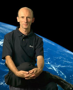
Crew members were Kevin Kregel (NASA), Dominic Gorie (NASA), Janet Kavandi (NASA), Janice Voss (NASA), Mamoru Mohri (NASDA), and Gerhard Thiele (ESA) on his first ever space mission. The SRTM payload is a joint project between NASA, NIMA (National Image and Mapping Agency), DLR (German Aerospace Centre) and ASI (Italian Space Agency).
This video provides a post flight summary of the mission, as follows:
00:05 STS-99 Shuttle Radar Topography Mission (SRTM)
00:08 Launch pad, dusk, Kennedy Space Center, Florida;
00:11 Shuttle crew arriving back to Houston following mission.
00:18 Kevin Kregel gives a short brief of the mission, just back at Houston and presenting the team
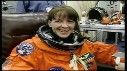
00:30 Crew suit up;
01:08 Crew take practise drive on armoured personnel carrier;
01:15 Mamoru Mohri (NASDA)
01:24 Crew leave operations and checkout building;
01:33 Shot of Space Shuttle Endeavour;
01:34 Crew helped into position for launch;
01:42 Shuttle on launch pad;
01:47 Ignition of main engines;
01:58 Various views of launch; interior view of crew at launch; jettison of solid rocket motors; external tank ejection;
02:07 Earth view from shuttle taking off; inside view of astronauts during launch
02:50 View of Shuttle and rockets clouds, and solid rocket boosters burned out
03:24 Ejection of external tank, viewed from the Shuttle
03:29 View of the Earth, very cloudy
03:33 Opening of payload doors; and explanation of what to do right after launch: getting rid of excess heat, open payload data radar and view of radar turning
03:59 Kavandi and Thiele turn on payload systems;
03:59 Extension of long antenna mast;
04:23 Graphic sequences showing mast extension;
04:39 Mast base plate locks;
04: 45 View of mast from Commander's window;
04:53 Graphics of antenna mast deployment;
05:00 Graphics showing antennae alignment and SRTM mapping system; explanation of what is seen by X and C band radars, and how the mapping is performed to cover the Earth surface
05:31 Mohri changes magnetic tapes used to record radar data; 330 tapes were recorded, and had to be changed during the 9-day mission, that is a tape-change every 30min.
05:47 Various footage of crew activities;
06:20 Mast moving; and the so called fly-cast manoeuvre
06:36 Various footage of crew activities; changing tapes again
07:20 Gerhard Thiele (ESA) exercising on a bike; washing hair; Mamoru Mohri (NASDA) exercising on a bike
08:22 Earth views from shuttle - Pacific Ocean through to Bolivia, South America,
08:33 Coral and sand of Bahamas,
08:44 Desert in Mauritania, Africa,
08:55 Irrigation patterns in Saudi Arabia,
09:05 Mount Fuji and Tokyo Bay, Japan,
09:26 Southern Russia and Black Sea,
09:37 Coastline of South America with Ecuador and Peru,
09:45 Mediteranean Sea, Malta, Italy,
09:57 Kamtchatka Peninsula featuring volcanic terrain;
10:07 View of radar mast over Earth; folding of antenna mast; mast fails to close, 2 inches short of complete folding;
10:53 Flight Director at Mission Control Center; closure of mast lip; images from Houston control centre
11:07 Footage of activities on board shuttle including crew dancing;
12:30 View of radar mast with moon background;
12:44 Various views of shuttle approaching Kennedy Space Center; landing sequence;
14:35 Crew pose for cameras with shuttle background;
14:47 Mapping of globe graphic.
14:55 The end
-
CREDIT
ESA -
LICENCE
ESA Standard Licence
-
Documentary
-
-
-
-
-
-
Animating Ascending Commanding Communicating Controlling Descending Drinking Experimenting Explaining Exploring Filming from space Flying Forecasting Heating Imaging Interviewing Landing Launching Mapping Measuring Mission planning Monitoring Observing Orbiting Picturing Pointing Positioning on Earth Predicting Presenting Re-entering Rotating Washing
-
3D models 3D view Agriculture Antenna Antenna pointing mechanism Applications from space Astronauts Aviation Bandwidth Camera Cargo Cartography Conference Control room Dams and water basins Data DLR Earth Earth views (taken by astronauts) Earth views (taken by satellites ) Earthquakes Ecological studies Engine Engineers Environment health Forest Illustrations Imager Images Inflight Instrument Interferometry Interview Laboratory Lakes and rivers Landscape Launch Launch pad Launcher Launchers artist views Manned Missions Manoeuvres Mission control NASA NASDA (Japanese Space Agency) Ocean Orbits Payload Radar Remote sensing Rotation Safety Sand Satellite image Shuttle launch Space walk Spacesuit Urban areas US Europe Cooperation USA Volcanoes

STS-99 Post Flight Presentation

Gerhard Thiele, Astronaut of the European Space Agency (ESA)

STS-103 Post Flight Crew Presentation

Gerhard Thiele mission


 Germany
 Austria
 Belgium
 Denmark
 Spain
Spain
 Estonia
 Finland
 France
 Greece
 Hungary
 Ireland
 Italy
Italy
 Luxembourg
 Norway
 The Netherlands
 Poland
 Portugal
 Czechia
 Romania
 United Kingdom
 Slovenia
 Sweden
 Switzerland


