Accept all cookies Accept only essential cookies See our Cookie Notice

About ESA
The European Space Agency (ESA) is Europe’s gateway to space. Its mission is to shape the development of Europe’s space capability and ensure that investment in space continues to deliver benefits to the citizens of Europe and the world.
Highlights
ESA - United space in Europe
This is ESA ESA facts Member States & Cooperating States Funding Director General Top management For Member State Delegations European vision European Space Policy ESA & EU Space Councils Responsibility & Sustainability Annual Report Calendar of meetings Corporate newsEstablishments & sites
ESA Headquarters ESA ESTEC ESA ESOC ESA ESRIN ESA EAC ESA ESAC Europe's Spaceport ESA ESEC ESA ECSAT Brussels Office Washington OfficeWorking with ESA
Business with ESA ESA Commercialisation Gateway Law at ESA Careers Cyber resilience at ESA IT at ESA Newsroom Partnerships Merchandising Licence Education Open Space Innovation Platform Integrity and Reporting Administrative Tribunal Health and SafetyMore about ESA
History ESA Historical Archives Exhibitions Publications Art & Culture ESA Merchandise Kids Diversity ESA Brand CentreLatest
Space in Member States
Find out more about space activities in our 23 Member States, and understand how ESA works together with their national agencies, institutions and organisations.
Science & Exploration
Exploring our Solar System and unlocking the secrets of the Universe
Go to topicAstronauts
Missions
Juice Euclid Webb Solar Orbiter BepiColombo Gaia ExoMars Cheops Exoplanet missions More missionsActivities
International Space Station Orion service module Gateway Concordia Caves & Pangaea BenefitsLatest
Space Safety
Protecting life and infrastructure on Earth and in orbit
Go to topicAsteroids
Asteroids and Planetary Defence Asteroid danger explained Flyeye telescope: asteroid detection Hera mission: asteroid deflection Near-Earth Object Coordination CentreSpace junk
About space debris Space debris by the numbers Space Environment Report In space refuelling, refurbishing and removingSafety from space
Clean Space ecodesign Zero Debris Technologies Space for Earth Supporting Sustainable DevelopmentLatest
Applications
Using space to benefit citizens and meet future challenges on Earth
Go to topicObserving the Earth
Observing the Earth Future EO Copernicus Meteorology Space for our climate Satellite missionsCommercialisation
ESA Commercialisation Gateway Open Space Innovation Platform Business Incubation ESA Space SolutionsLatest
Enabling & Support
Making space accessible and developing the technologies for the future
Go to topicBuilding missions
Space Engineering and Technology Test centre Laboratories Concurrent Design Facility Preparing for the future Shaping the Future Discovery and Preparation Advanced Concepts TeamSpace transportation
Space Transportation Ariane Vega Space Rider Future space transportation Boost! Europe's Spaceport Launches from Europe's Spaceport from 2012Latest
EGNOS helping the visually impaired citizens - Mobile Orientation
A prototype satellite navigation system known as MOMO, accurate enough to direct vision-impaired pedestrians to their destination, has been successfully demonstrated in Madrid. It is based on the European Geostationary Navigation Overlay Service (EGNOS), a joint project of ESA, the European Commission and Eurocontrol.
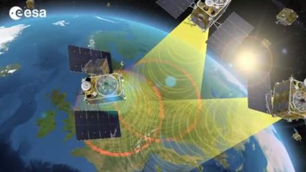
EGNOS consists of a network of around 40 ground stations scattered throughout Europe designed to record, adjust and improve data from the American GPS system. Geostationary satellites relay the modified signals to the receivers of system users. In contrast to the 15–20 metre accuracy offered by GPS, the European system is accurate to better than two metres.
Seen from a distance, a blind man guided by his dog in the streets of Madrid seems quite sure of his way. He is receiving directions to his destination through his headphones: “turn to the right, turn to the left, continue straight ahead…” Thanks to a mobile phone combined with a position receiver and a voice synthesizer, he can travel confidently through the city while being guided by satellite.
Developed by ESA, with the Spanish firm GMV Sistemas, this device offers greater autonomy for the visually impaired. The system is not intended to replace a white cane or a guide dog but to complement them with an ‘audible map’.
This system, designed with the advice of the Spanish National Organisation for the Blind (Organisacion Nacional de los Ciegos de España – ONCE), relies on the increased accuracy of EGNOS. This is rather important for a blind person, since a localisation accuracy of one metre makes the difference between being on the pathway or in the road.
The MOMO system also makes use of another ESA-developed system: SISNeT (Signal In Space via Internet). In an urban environment, buildings often prevent or interfere with reception of satellite signals. SISNeT overcomes this problem by providing EGNOS data via the Internet, enabling users like the person in the film to access it via a mobile data service.
EGNOS is Europe’s first venture in the field of satellite navigation and is the precursor to Galileo, a civilian Global Navigation Satellite System (GNSS).
-
CREDIT
ESA -
LICENCE
ESA Standard Licence
-
Documentary
-
-
-

A Guide Dog with Satellite Technology

A Guide Dog with Satellite Technology

Satellite Navigation Index

EGNOS and Harvesting


 Germany
 Austria
 Belgium
 Denmark
 Spain
Spain
 Estonia
 Finland
 France
 Greece
 Hungary
 Ireland
 Italy
Italy
 Luxembourg
 Norway
 The Netherlands
 Poland
 Portugal
 Czechia
 Romania
 United Kingdom
 Slovenia
 Sweden
 Switzerland


