About ESA
The European Space Agency (ESA) is Europe’s gateway to space. Its mission is to shape the development of Europe’s space capability and ensure that investment in space continues to deliver benefits to the citizens of Europe and the world.
Highlights


Latest


Space in Member States
Find out more about space activities in our 23 Member States, and understand how ESA works together with their national agencies, institutions and organisations.
 Germany
 Austria
 Belgium
 Denmark
 Spain
Spain
 Estonia
 Finland
 France
 Greece
 Hungary
 Ireland
 Italy
Italy
 Luxembourg
 Norway
 The Netherlands
 Poland
 Portugal
 Czechia
 Romania
 United Kingdom
 Slovenia
 Sweden
 Switzerland
Science & Exploration
Exploring our Solar System and unlocking the secrets of the Universe
Go to topicAstronauts


Latest


Enabling & Support
Making space accessible and developing the technologies for the future
Go to topicLatest


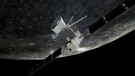
Simulation of BepiColombo's sixth flyby Mercury views

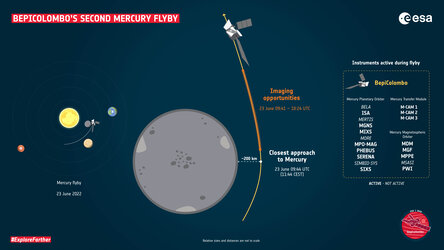
During its sixth flyby of Mercury, the ESA/JAXA BepiColombo mission will fly directly over the planet's north pole. While doing so, the spacecraft will snap photos of the cratered surface below, providing the most up-to-date views of Mercury's ‘top half’ since NASA's Messenger finished its mission in 2015.
This simulation shows the surface of Mercury passing below the spacecraft as it will be viewed by one of its monitoring cameras, M-CAM 1. BepiColombo will approach the planet from its night side, so the surface to the right of the ‘terminator’ which divides night and day on the planet – the blue line visible from around 25 seconds into the video – will be shrouded in darkness.
This flyby will provide the first close views in ten years of mysterious north pole craters whose insides are cast in permanent shadow. Excitingly, these craters are thought to contain water ice. M-CAM 1 will take some extra-long exposure images in the hopes of revealing more of what's inside, dimly lit by sunlight reflected from the craters' walls.
The ‘enhanced colour’ planetary surface shown in this simulation is a fake-colour composite map which highlights differences in surface composition, based on Messenger observations (Denevi et al., 2018). While a complete greyscale map is available, the lack of complete multi-colour data from around the planet's north pole means that this surface model has a gap of coverage in that region.
The simulated video was prepared by Emanuele Simioni with SOIM, short for Simulator for Operation of Imaging Missions. This software uses the most up-to-date mission data to calculate the exact position of Mercury, the spacecraft and the instrument geometry, determining what each of its cameras will see.
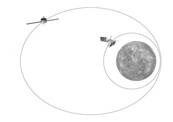
In late 2026, the ‘stacked’ BepiColombo spacecraft will arrive at Mercury and release both ESA's Mercury Planetary Orbiter (MPO) and JAXA's Mercury Magnetospheric Orbiter (Mio) into polar orbits around the planet. This means that both orbiters will have full coverage of the planet's poles with their various instruments. MPO's cameras and spectrometers will improve upon Messenger's maps, providing global surface coverage in higher resolution and expanding to more wavelengths of light.