Satellite tracking campaign tests European abilities
An experimental tracking campaign using European facilities is helping determine how well existing telescopes and radars can work together to observe objects in Earth orbit. The results will be used to help design ESA's future Space Situational Awareness system.
On 29 November, experts from the Agency's Space Situational Awareness (SSA) Preparatory Programme began an experimental tracking campaign using scientific research telescopes and radars in five European countries. The campaign is testing how well existing facilities can track potential debris hazards in orbit using known satellites as targets.
A series of three overnight tests during November to February will see the radars and telescopes being used to track a dozen candidate 'objects' – existing satellites including ESA's GOCE, Artemis and Envisat. Other European satellite operators, including Eumetsat and SES-Astra, have agreed to the use of their satellites in the tracking campaign as well.
Facilities in Sweden, UK, Switzerland, Spain and Cyprus
To track objects in low orbit – just several hundred kilometres altitude – the campaign is making use of research radars operated by the European Incoherent Scatter Scientific Association (EISCAT) in Sweden and Norway, and by the Chilbolton Observatory in Hampshire, UK.

For objects in geostationary orbit – up to 36 000 km altitude – the tests will use optical telescopes, including ESA's own Optical Ground Station in Tenerife, Spain.
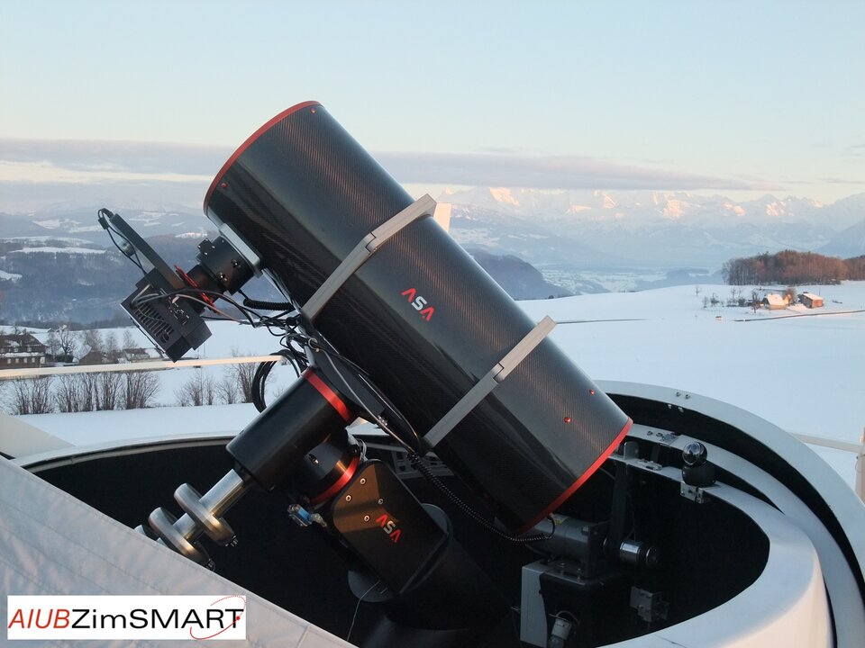
In addition, astronomical observatories in Spain (Observatorio Astronómico de Mallorca), Switzerland (Zimmerwald Observatory) and Troodos, Cyprus (British National Space Centre – Starbrook) will be used.
Testing diverse sensors for interoperability
Some of the radars and telescopes were originally designed for meteorological, ionospheric or astronomical studies, so their use for tracking objects in Earth orbit is complementary but has not been fully tested.
"A significant goal of the campaign is determining how well these facilities can provide tracking data and identifying any operational problems related to, for example, weather or interoperability issues," says Emmet Fletcher, Head of the Space Surveillance and Tracking (SST) Segment at ESA's SSA programme.

Fletcher says that knowing how a diverse network of independent sensors can work together is critical for designing the architecture of the future European hazard-tracking system.
Results from the campaign will be used to assess the potential performance of the current European infrastructure, and how the future SST tracking capability should be designed to best make use of such assets.
About Europe's space hazard tracking capability
Under the SSA Preparatory Programme, a main aim of the SST element is to provide an independent ability to promptly acquire and catalogue precise information on objects orbiting Earth. Using these data, a wide range of services will be provided by the future European SSA System, such as warning of potential collisions and alerting when and where debris reenters Earth's atmosphere. These data will be stored in a catalogue and made available to SSA customers across Europe.

The infrastructure required to provide these capabilities is referred to as the '‘SST Segment'. It comprises surveillance and tracking sensors, which could use radar or optical technology, to acquire raw data, which are then processed to correlate (or link) each observed object with ones already known, or to indicate a new object.
Initially, the SST Segment will obtain data using existing sensors. When the full SSA programme begins, additional systems may be developed and deployed as required to achieve the objective of European autonomy in this area. The decision for the continuation of the SSA Programme is planned to be taken at the next ESA Ministerial Council, foreseen in 2012.
Contact
Emmet Fletcher, Head SST Segment
ESA Space Situational Awareness Preparatory Programme Office
ESA/ESAC, Spain
emmet.fletcher [@] esa.int
Tel. +34 91 81 31 508


 Germany
 Austria
 Belgium
 Denmark
 Spain
Spain
 Estonia
 Finland
 France
 Greece
 Hungary
 Ireland
 Italy
Italy
 Luxembourg
 Norway
 The Netherlands
 Poland
 Portugal
 Czechia
 Romania
 United Kingdom
 Slovenia
 Sweden
 Switzerland


