Protecting Europe’s Marine Environment
The seas around Europe are under threat from loss of biodiversity, habitat degradation, and climate change related warming and changes in salinity. In addition, European water bodies receive agricultural, domestic and industrial pollutants, recreational pressures of the leisure industry, and intensive fishing and farming of marine organisms.
These pressures are interconnected and may be acting simultaneously to reduce water quality and contribute to the deterioration of the ecosystems. To reduce, stop, or even reverse negative trends, National and European policies have recently been agreed to assess and monitor the present quality status of water bodies. Appropriate monitoring systems are now being put in place to support these policies and these are now recognising the potential contribution of new technologies such as satellite remote sensing as a cost effective contribution to an overall integrated monitoring system.
The global sea surface temperature has warmed by a mean of 0.6 °C since the late 19th century. At the same time, eutrophication has been recognised over many years as one of the most important problems facing European coastal waters. Furthermore, it exhibits significant regional and seasonal variability.

The rise in the sea surface temperature and the intensified eutrophication phenomena may cause a higher frequency of anomalous and toxic phytoplankton bloom events. Algae blooms may produce high biomass quantities at sea and sometimes become toxic for fish, wildlife and humans. The potential danger of algae blooms depends on their toxicity and geographic distribution. In addition, Harmful Algal Blooms (HAB) may contribute to oxygen depletion but also disturb recreational activities. Therefore such events must be carefully monitored at regional and local level.
As a result of the different drivers highlighted, coastal managers need to monitor a variety of phenomena to understand the extent to which coastal waters are safe as well as the state and health of associated ecosystems and habitats. The Water Framework Directive sets standards for the areas within which monitoring is required in order to ensure water bodies are maintained in a healthy and sustainable state. For coastal areas, the Water Framework Directive covers only the region within 1 nautical mile from the coastline. The new Marine Strategy Directive will ensure a wider coverage of European waters and require effective monitoring and management of the health and status of Europe’s marine environment.

Satellite based ocean colour measurements can make a significant contribution to the monitoring of water quality parameters to support regional authorities ensure a safe environment for the different coastal activities (eg aquaculture, leisure activities, habitat protection) and national authorities to comply with legislation such as the Marine Strategy and Water Framework Directives. At the same time, regular satellite based ocean colour measurements can also provide early warning of the onset of algal blooms. The main benefits when combined with conventional monitoring capabilities are an increased frequency of monitoring, greater spatial coverage and the possibility to better understand the fine scale spatial variations between adjacent measurement stations.
The figure demonstrates the different between a weekly composite MERIS image for the North Sea area and the measurement stations sampled once per year by BSH in terms of the availability of data.
Satellite measurements are therefore widely used for coastal water quality monitoring around Europe today. Some examples are highlighted below.
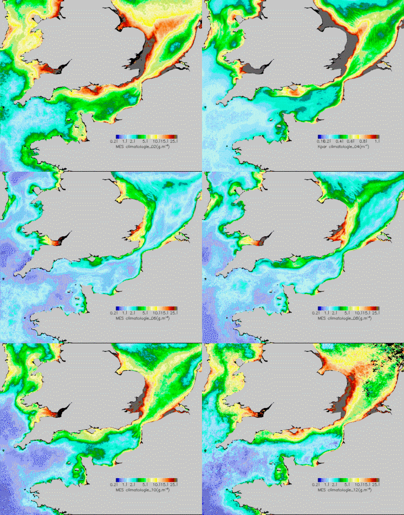
The ESA financed MARCOAST project provides water quality information services to a range of national and European level users on a regular basis. A selection of the most recent products delivered is shown below.


 Germany
 Austria
 Belgium
 Denmark
 Spain
Spain
 Estonia
 Finland
 France
 Greece
 Hungary
 Ireland
 Italy
Italy
 Luxembourg
 Norway
 The Netherlands
 Poland
 Portugal
 Czechia
 Romania
 United Kingdom
 Slovenia
 Sweden
 Switzerland


