Hurricane Dean tracked from space
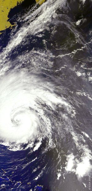
ESA satellites are tracking the path of Hurricane Dean as it rips across the Caribbean Sea carrying winds as high as 260 km/h. The hurricane, which has already claimed eight lives, is forecast to slam into Mexico’s Yucatan Peninsula on Tuesday morning.
Dean was upgraded early Tuesday to a Category 5 – the highest on the Saffir-Simpson scale – before pummelling the peninsula. Knowing the strength and path of hurricanes is critical for issuing timely warnings; satellites are the best means of providing data on the forces that power the storm, such as cloud structure, wind and wave fields, sea surface temperature and sea surface height.
Instruments aboard ESA’s Envisat and ERS-2 satellites allow them to peer through hurricanes. Envisat carries both optical and radar instruments, enabling researchers to observe high-atmosphere cloud structure and pressure in the visible and infrared spectrum.
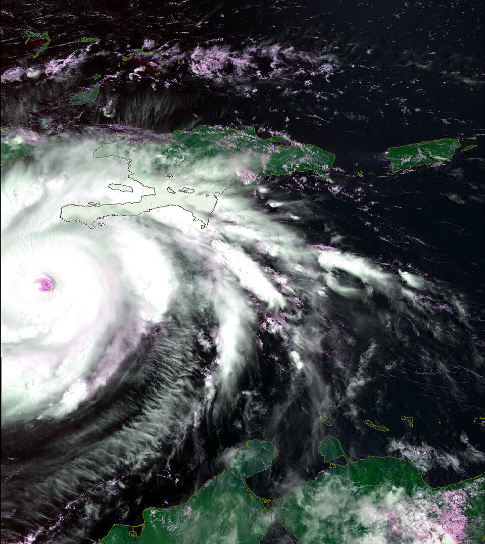
The Medium Resolution Imaging Spectrometer (MERIS) optical instrument shows the swirling cloud-tops of a hurricane, while radar instruments such as the Advanced Synthetic Aperture Radar (ASAR) pierce through the clouds to show how the wind fields shape the sea surface and estimate their likely destructive extent.
ERS-2 uses its radar scatterometer to observe the hurricane's underlying wind fields. The scatterometer instrument works by firing a trio of high-frequency radar beams down to the ocean, then analysing the pattern of backscatter reflected up again. Wind-driven ripples on the ocean surface modify the radar backscatter, and as the energy in these ripples increases with wind velocity, backscatter increases as well. Scatterometer results enable measurements not only of wind speed but also of direction across the water surface.
What makes ERS-2's scatterometer especially valuable is that its C-band radar frequency is almost unaffected by heavy rain, so it can return useful wind data even from the heart of the fiercest storms.

Dr Ad Stoffelen of the Royal Netherlands Meteorological Institute (KNMI), which processes ESA’s scatterometer images, said: "Observed winds from hurricane Dean by ESA's ERS-2 scatterometer are provided to meteorologists within the hour. This C-band radar wavelength scatterometer peeks right into the ‘eye’ of a hurricane like Dean, providing timely and precise information on its position and force.
"The wind field derived from the ESA ERS-2 scatterometer measurements are distributed via a EUMETSAT (European Organisation for the Exploitation of Meteorological Satellites) project to a registered database of a few hundred users, originating from all over the world, includng the Americas, Australia, Asia and Europe. Scatterometer winds are used directly by shift meteorologists in forecast rooms and to initialise Numerical Weather Prediction models aiding the forecasting of hurricanes 5 days ahead."

Another Envisat instrument called the Radar Altimeter-2 (RA-2) uses radar pulses to measure sea surface height (SSH) down to an accuracy of a few centimetres. Near-real time radar altimetry is a powerful tool for monitoring a hurricane's progress and predicting its potential impact because anomalies in SSH can be used to identify warmer ocean features such as warm core rings, eddies and currents.
Water temperatures are the main underlying energy reservoir that power hurricanes; together with the correct atmospheric conditions, temperatures need to exceed 26ºC in order to form and maintain a tropical cyclone. Because warm water expands, scientists can locate warm underwater ocean features by detecting bulges in the ocean surface height, as detected by RA-2.

The thermal energy of warm water, which partly powers a hurricane, is known as tropical cyclone heat potential (TCHP). Warm waters may extend to at least 100 metres beneath the surface in many of these oceanic features, representing waters of very high heat content. Several hurricanes have intensified when their tracks pass over eddies or other masses of warm water with high TCHP values.
The US National Oceanic and Atmospheric Administration (NOAA) is using Envisat RA-2 results along with those from other space-borne altimeters to chart TCHP and improve the accuracy of hurricane forecasting.

Envisat's Advanced Along Track Scanning Radiometer (AATSR) works like a space-based thermometer, acquiring the temperature of the sea surface down to a fraction of a degree. It also returns useful atmospheric data, measuring the temperature of the top of hurricane clouds – the higher into the atmosphere they extend, the colder they are.
AATSR information can be correlated with MERIS data cloud height and development to gain a good estimate of the hurricane's precipitation potential, and improve understanding of how this relates to its overall intensity. Condensation of water vapour releases latent heat, which warms the vicinity of the hurricane eye. This in turn evaporates more surface water and feeds the heat engine powering the hurricane.
The International Charter 'Space and Major Disasters' has been activated to provide Earth Observation satellite data for assessing the damage of Hurricane Dean in Belize.


 Germany
 Austria
 Belgium
 Denmark
 Spain
Spain
 Estonia
 Finland
 France
 Greece
 Hungary
 Ireland
 Italy
Italy
 Luxembourg
 Norway
 The Netherlands
 Poland
 Portugal
 Czechia
 Romania
 United Kingdom
 Slovenia
 Sweden
 Switzerland


