Top Earth observation stories of 2024
This year has been a whirlwind of fascinating Earth observation stories, from dramatic volcanic eruptions to Saharan dust plumes to epic meteorite craters. Let’s dive into some of the most memorable highlights from 2024.
ERS-2’s fiery farewell
In February, ESA’s European Remote Sensing 2 satellite (ERS-2) made a fiery reentry into Earth’s atmosphere after nearly 30 years of service.
Launched in April 1995, ERS-2 provided invaluable data on Earth’s land surfaces, ocean temperatures, ozone layer and polar ice extent.
Even today, its data are still widely used today and are accessible through ESA’s Heritage Space Programme, contributing to the monitoring of essential climate variables.
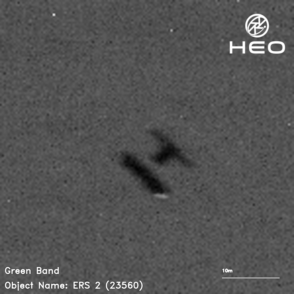
The image below shows ERS-2 as it descended through the atmosphere. These images were captured by cameras on board other satellites by Australian company HEO on behalf of the UK Space Agency.
Read the full story: ERS-2 reenters Earth’s atmosphere over Pacific Ocean
Total solar eclipse
In April, a total solar eclipse swept across North America, briefly blocking out the Sun and plunging parts of the continent into darkness. Geostationary satellites orbiting 36 000 km away captured stunning images of this rare celestial event.
The Geostationary Operational Environmental Satellite (GOES-16) recorded the Moon’s shadow traversing North America. A total solar eclipse occurs when the Moon passes between the Sun and Earth, temporarily blocking the Sun’s face, leaving only a ring of light known as the Sun’s corona visible.
The path of the Moon’s shadow, known as the path of totality, stretched across North America, from Mexico to the eastern tip of Canada.

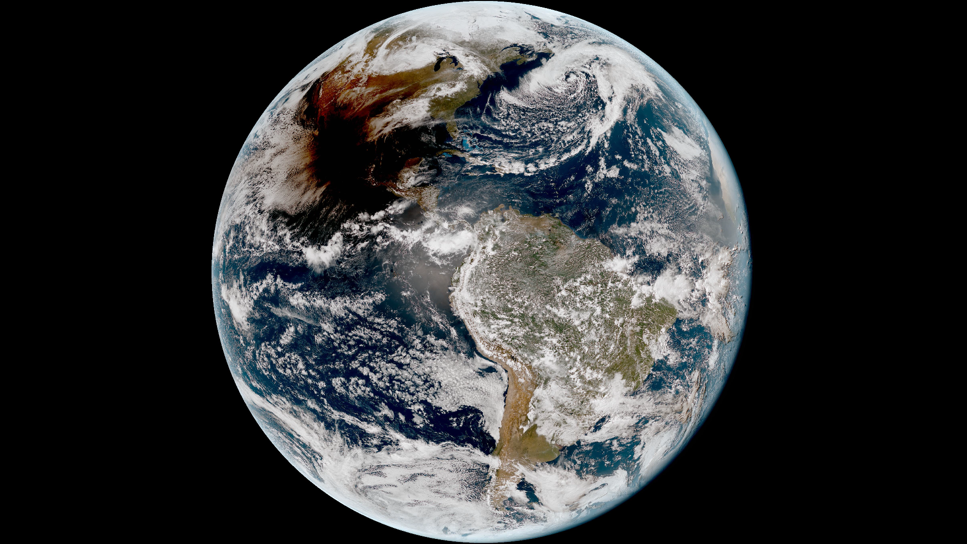
Access the video
EarthCARE: unveiling the secrets of clouds
EarthCARE, ESA’s Earth Cloud, Aerosol and Radiation Explorer, launched in May 2024, heralding a new chapter in climate research.
Equipped with four state-of-the-art instruments – a cloud profiling radar, an atmospheric lidar, a broadband radiometer and a multispectral imager – EarthCARE makes a range of different measurements simultaneously. Together, these measurements help understand how clouds and aerosols reflect incoming solar energy back out to space and how they trap outgoing infrared energy.
This information is crucial for understanding how climate change is affecting Earth’s energy balance and for predicting the rate at which clouds and aerosols could lose their current overall cooling effect in the future.
The animation below demonstrates how these four advanced sensors work in synergy.
Read the full story: EarthCARE synergy reveals power of clouds and aerosols


Access the video
Arctic Weather Satellite: improving Arctic weather forecasts
In August, ESA’s Arctic Weather Satellite (AWS) launched, filling critical gaps in polar weather forecasting. Equipped with advanced sensors, AWS monitors temperature, humidity and atmospheric conditions, offering unparalleled insights into the rapidly changing Arctic climate.
Just a month after launch, the satellite captured its first images of Storm Boris, which wreaked havoc across central Europe.
Its ability to measure ‘brightness temperature’ unveiled the torrential rainfall’s impact in vivid detail. The animation below shows measurements from September, with lower values (depicted in blue) indicating higher humidity levels. The torrential rainfall from Storm Boris is especially evident as dark blue regions low in the atmosphere over Hungary, Slovakia and Poland.
Read full story: Arctic Weather Satellite’s first images capture Storm Boris

Φsat-2: AI for Earth observation
Launched alongside the Arctic Weather Satellite, Φsat-2 (PhiSat-2) is ESA’s innovative cubesat showcasing the power of artificial intelligence for Earth observation.
The miniature satellite is equipped with a state-of-the-art multispectral camera and powerful AI computer that analyses and processes imagery while in orbit. The data will prove critical for disaster response efforts, maritime monitoring, environmental protection and more.
Sentinel-2C: keeping a watchful eye
September saw the launch of Copernicus Sentinel-2C satellite. Like its siblings, Sentinel-2A and Sentinel-2B, the satellite carries a multispectral imager to capture high-resolution images of Earth’s land, islands, and inland and coastal waters from 786 km.
Just a week after launch, Sentinel-2C acquired a rich initial set of images across the globe.
Although Sentinel-2C is designed for Earth observation, on 20 September, the Copernicus Sentinel-2C satellite captured its first stunning image of the Moon, achieved by rolling the satellite sideways in a unique manoeuvre.
Read the full story: Sentinel-2C delivers stunning first images

Satellites monitor Valencia flood disaster
In November, torrential rain unleashed deadly flash floods across southern and eastern Spain in regions including the Costa del Sol and Valencia.
Earth observation imagery and data played a crucial role in responding to the disaster. Optical images illustrated the extent of the devastation, while radar data mapped flood severity in detail.
Spain’s Civil Protection Agency activated the International Charter ‘Space and Major Disasters,’ pooling resources from 17 space agencies to provide vital analysis for relief efforts.
Read the full story: Devastating floods in Spain witnessed by satellites


Open Image
Sentinel-1C takes off
The Copernicus programme celebrated another milestone with the launch of Sentinel-1C in December. This radar imaging satellite enhances the mission’s ability to monitor Earth's surface in all weather conditions, including tracking ice, detecting oil spills and mapping floods.
Less than a week after launch, the satellite delivered its first radar images over Europe. The image below was part of its initial set and showcases part of the Netherlands, including Amsterdam and the region of Flevoland, renowned for its extensive farmland and advanced water management systems.
This image echoes the very first SAR image acquired by the legacy European Remote-Sensing (ERS) mission in 1991, which captured the Flevoland polder and the Ijsselmeer, marking a full circle moment for ESA.
Read the full story: Sentinel-1C captures first radar images


 Germany
 Austria
 Belgium
 Denmark
 Spain
Spain
 Estonia
 Finland
 France
 Greece
 Hungary
 Ireland
 Italy
Italy
 Luxembourg
 Norway
 The Netherlands
 Poland
 Portugal
 Czechia
 Romania
 United Kingdom
 Slovenia
 Sweden
 Switzerland


