About ESA
The European Space Agency (ESA) is Europe’s gateway to space. Its mission is to shape the development of Europe’s space capability and ensure that investment in space continues to deliver benefits to the citizens of Europe and the world.
Highlights


Latest


Space in Member States
Find out more about space activities in our 23 Member States, and understand how ESA works together with their national agencies, institutions and organisations.
 Germany
 Austria
 Belgium
 Denmark
 Spain
Spain
 Estonia
 Finland
 France
 Greece
 Hungary
 Ireland
 Italy
Italy
 Luxembourg
 Norway
 The Netherlands
 Poland
 Portugal
 Czechia
 Romania
 United Kingdom
 Slovenia
 Sweden
 Switzerland
Science & Exploration
Exploring our Solar System and unlocking the secrets of the Universe
Go to topicAstronauts


Latest


Enabling & Support
Making space accessible and developing the technologies for the future
Go to topicLatest


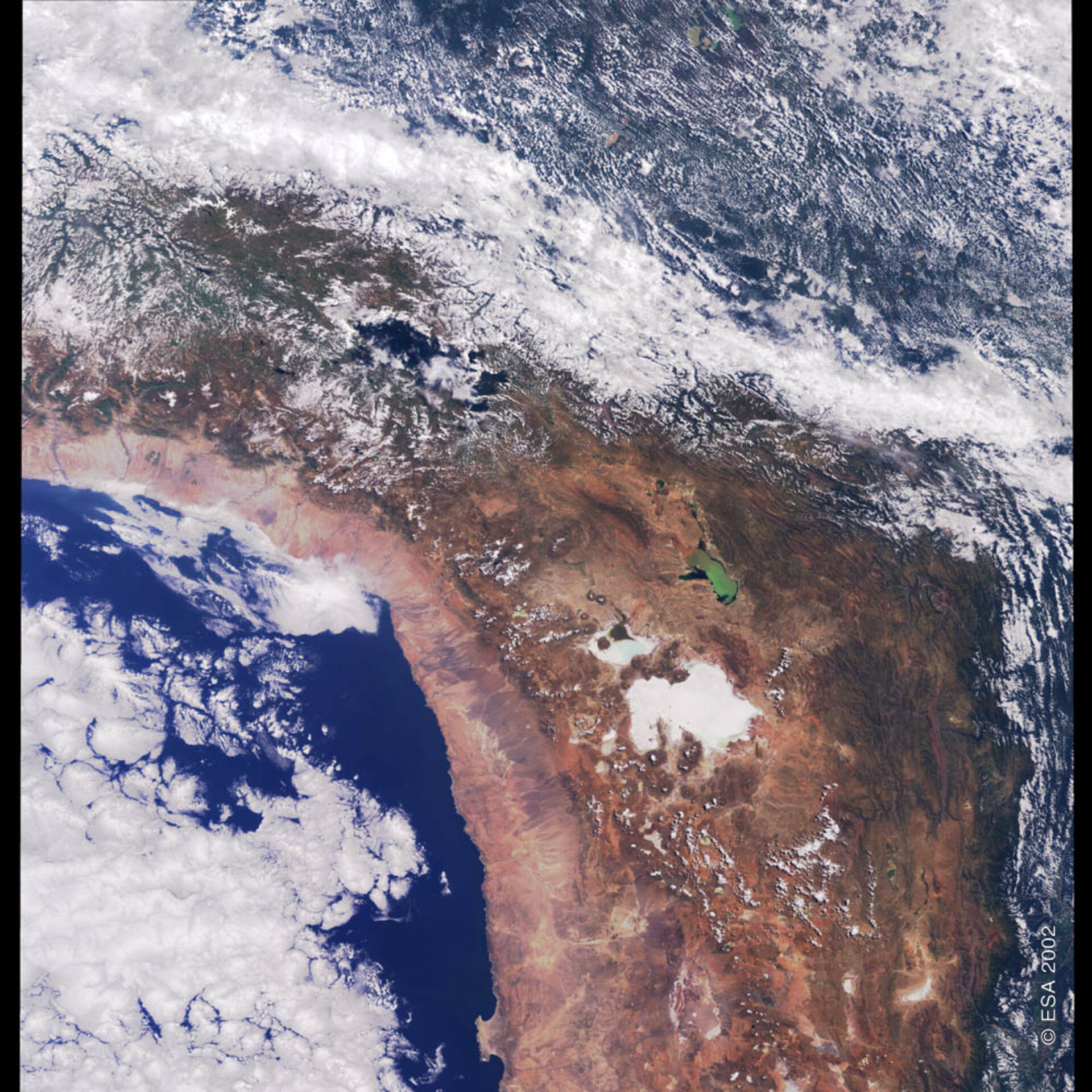
Bolivia and Chile - MERIS - 23 April 2002
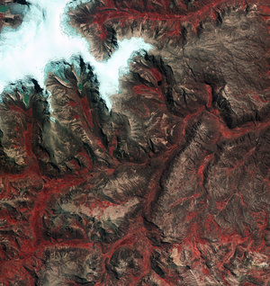
A large part of Bolivia is the so-called Altiplano, an 800-km long and 130-km wide region lying between the Cordillera Occidental and the Cordillera Oriental. In the northern part of the Altiplano, where the bulk of the population and industry of Bolivia is found, is Lake Titicaca, the highest large, navigable lake in the world. Located at an altitude of 3804 m with a depth exceeding 300 m, the lake separates Bolivia from Peru. The southern part of the Altiplano plateau is arid with saline soils.
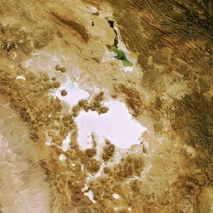
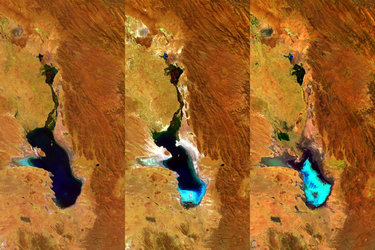
Lake Poopo, the green lake, is 300 km southeast of Lake Titicaca and is one of many saline lakes on the region. This lake was dramatically polluted in February 2000 by an accidental 39 000-barrel oil spill. Its green colour is due to its shallow waters.
Chile starts approximately at Lake Poopo’s latitude and extends as a narrow 200-km wide strip of land southwards, along the Pacific Ocean. The northern part of Chile visible in the image is the Atacama Desert, the world’s driest, with parts where rain has never been recorded and the only precipitation is in the form of fog. The desert, a series of salt basins that cannot support any vegetation, is flanked on one side by Pacific coastal ranges and on the other by the snow-capped peaks of the Andes.
Technical Information:
Instrument: Medium Resolution Imaging Spectrometer (MERIS)
Date of Acquisition: 23 April 2002
Orbit number: 00322
Instrument features: Full resolution image (300-meter resolution)