
Hungary and Slovenia - ASAR - 07 July 2003
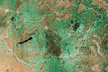
This Advanced Synthetic Aperture Radar (ASAR) multi temporal colour composite image represents an area of 100 Km swath width, covering part of the Danube Basin. The image is composed of three ASAR IMP images acquired on different dates and assigning a colour (RGB) to each date (Red: 04 November 2002 - Green: 07 July 2003 - Blue: 24 March 2003).
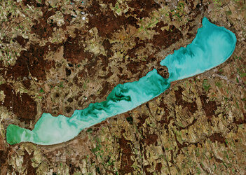
Hungary with the largest lake in central Europe, Lake Balaton, is seen in the top right part of the image and part of the mountainous country of Slovenia is shown on the bottom left corner. The Danube tributary rivers like Drava River, seen in the image flowing from west to southeast, provide highly fertile soils for agricultural use throughout the basin. Several agricultural fields are clearly visible in the image in a large variety of colours depending on the temporal and seasonal evolution of the crops.
Technical Information:
Instrument: Advanced Synthetic Aperture Radar (ASAR)
Date of Acquisition: Red: 04 November 2002, Green: 07 July 2003, Blue: 24 March 2003
Orbit number: 03561, 07068, 05565.
Orbit direction: Ascending
ASAR features: Image Mode Precision (30 metre resolution)
ASAR mode: Image Swath 2 (104.8 km wide)
ASAR polarisation: VV
Coordinates:
NE Lat/Long: N 47.11 / E 17.32
NW Lat/Long: N 46.90 / E 15.96
SW Lat/Long: N 45.97 / E 16.28
SE Lat/Long: N 46.17 / E 17.61


