Subsurface echoes from buried basins
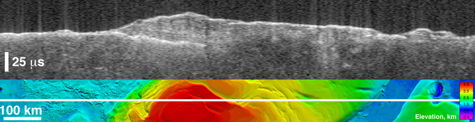
LEFT: (Top) This radargram obtained thanks to data form the MARSIS sounding radar on board ESA’s Mars Express on 4 July 2005 (orbit 1886), showing parabolic-shaped echoes from the rim walls of a buried impact basin. (Bottom) The parabolic echoes project to circular arcs on the surface and indicate the location of a 210 km-diameter impact basin in Amazonis Planitia buried by young lava flows. The dashed white circles are approximate fits to the arcs (echoes labelled in the radargrams). The echoes are interpreted to be from the top and bottom rim wall of the basin.
RIGHT: (Top) This MARSIS radargram was obtained thanks to data gathered on 7 July 2005 (orbit 1897) and shows a parabolic-shaped echo from the rim wall of a buried impact basin. (Bottom) The surface projection of the parabolic echo indicates a 140 km-diameter basin in Amazonis Planitia buried by young lava flows. The dashed white circles are approximate fits to the arcs (echoes labelled in the radargrams). The echoes are interpreted to be from the far rim wall of the basin.
The best fit to the echo indicates that the orbit track is offset from the basin centre, thus the left/right ambiguity in the data does not allow a unique determination of the basin centre. The two bottom images show the subsurface echoes projected on MOLA colour-coded shaded relief.
Subsurface echoes from Chryse Planitia plains

Other subsurface echoes from buried basins

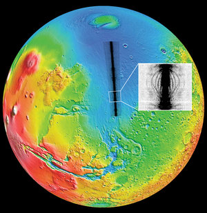
Location of buried basins detected by MARSIS

Radar echoes