About ESA
The European Space Agency (ESA) is Europe’s gateway to space. Its mission is to shape the development of Europe’s space capability and ensure that investment in space continues to deliver benefits to the citizens of Europe and the world.
Highlights


Latest


Space in Member States
Find out more about space activities in our 23 Member States, and understand how ESA works together with their national agencies, institutions and organisations.
 Germany
 Austria
 Belgium
 Denmark
 Spain
Spain
 Estonia
 Finland
 France
 Greece
 Hungary
 Ireland
 Italy
Italy
 Luxembourg
 Norway
 The Netherlands
 Poland
 Portugal
 Czechia
 Romania
 United Kingdom
 Slovenia
 Sweden
 Switzerland
Science & Exploration
Exploring our Solar System and unlocking the secrets of the Universe
Go to topicAstronauts


Latest


Enabling & Support
Making space accessible and developing the technologies for the future
Go to topicLatest


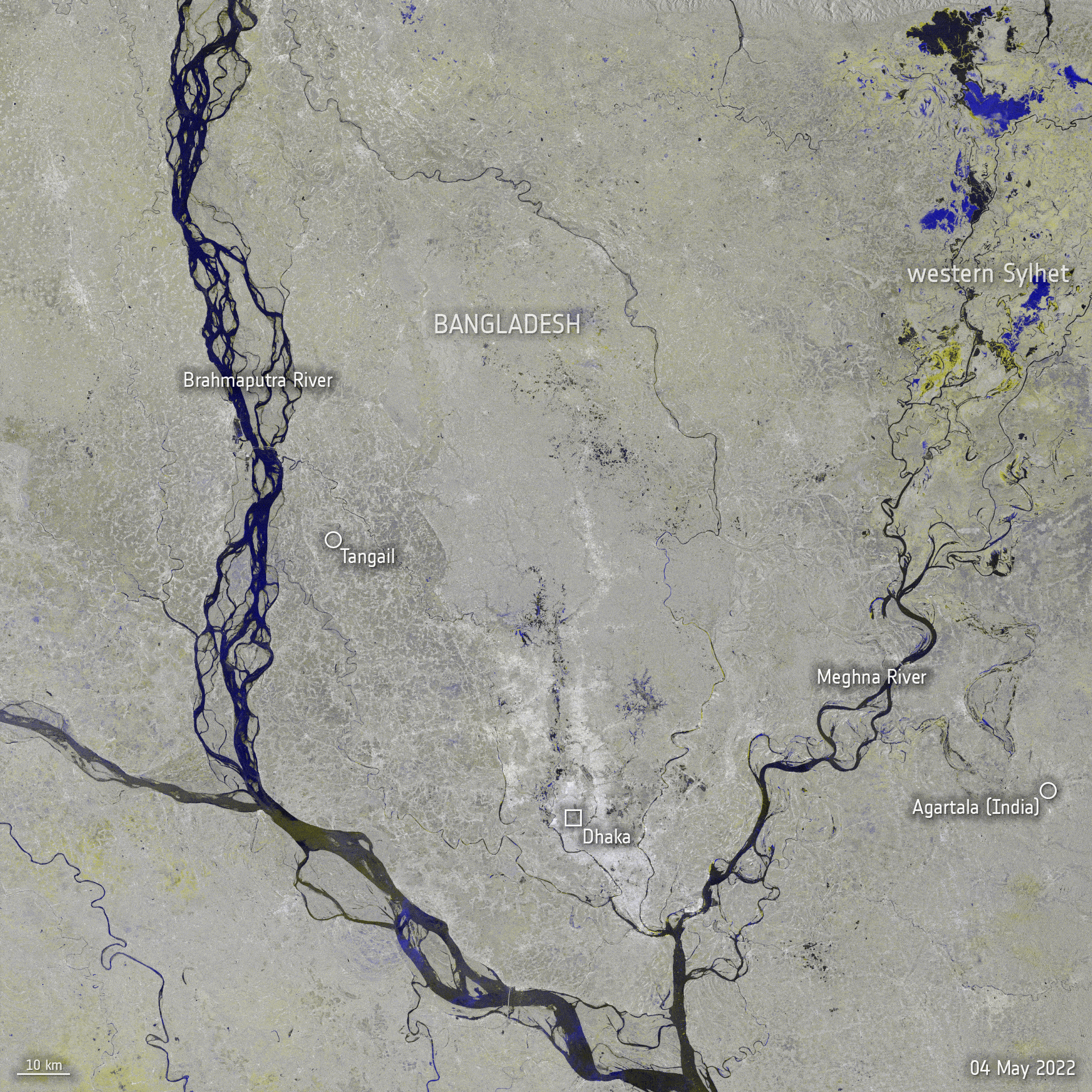
Flooding in Bangladesh
This multitemporal radar image, acquired by Envisat's Advanced Synthetic Aperture Radar (ASAR) instrument, is composed of two images - one acquired on 26 July 2007 and another on 12 April 2007 - and highlights the flooding in Bangladesh and parts of India brought on by two weeks of persistent rain.
ASAR is able to peer through clouds, rain or local darkness, and is well suited for differentiating between waterlogged and dry land. Areas in black and white denote no change, while areas outlined in blue are potentially flooded spots. Areas in red may also indicate flooding, but could also be related to agricultural practices.
The bright white area on the bottom left of the image is Calcutta, and Dhaka, the capital of Bangladesh, is visible as the bright white area in the centre right. The mouth of the Ganges is visible in the centre, and the Brahmaputra River is seen (blackish colour) splitting into two branches.