About ESA
The European Space Agency (ESA) is Europe’s gateway to space. Its mission is to shape the development of Europe’s space capability and ensure that investment in space continues to deliver benefits to the citizens of Europe and the world.
Highlights


Latest


Space in Member States
Find out more about space activities in our 23 Member States, and understand how ESA works together with their national agencies, institutions and organisations.
 Germany
 Austria
 Belgium
 Denmark
 Spain
Spain
 Estonia
 Finland
 France
 Greece
 Hungary
 Ireland
 Italy
Italy
 Luxembourg
 Norway
 The Netherlands
 Poland
 Portugal
 Czechia
 Romania
 United Kingdom
 Slovenia
 Sweden
 Switzerland
Science & Exploration
Exploring our Solar System and unlocking the secrets of the Universe
Go to topicAstronauts


Latest


Enabling & Support
Making space accessible and developing the technologies for the future
Go to topicLatest


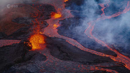
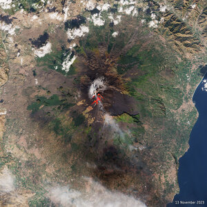
Mount Mayon, Philippines
The Copernicus Sentinel-1B satellite takes us over one of the most active volcanos in the world: Mount Mayon on the island of Luzon in the Philippines.
Luzon is the biggest island in the Philippines and home to most of the country’s active volcanoes. This volcanism is associated with plate tectonic processes where the floor of the South China Sea is being drawn down into the mantle along the Manila Trench, which is to the west of the island. The image just shows part of the southern end of this large island, but features no less than five volcanoes.
While Mount Mayon – the most southerly volcano in the image – is famous not only for being perfectly formed, but also for being one of the most active in the world, the other four volcanoes in the image are actually either dormant or extinct.Dubbed a perfect volcano because of its symmetry, Mount Mayon has a classical conical shape, built up by many layers of hardened lava. It erupts frequently with the most recent eruption occurring in January this year.
This image was captured on 16 January 2018 and while satellite radar isn’t typically used to detect hot lava flows, the way it has been processed reveals a pink line running down the southeast flank of the volcano that matches the flow of lava in optical images from satellites such as Sentinel-2. The predominant bright green in the image corresponds to vegetation, the lighter green and pink to towns and the blue to cultivated fields.
While the Sentinel-1 radar mission is used for a myriad of everyday applications, it is also used to detect ground movement, which is essential for monitoring shifts from earthquakes and volcanic uplift.
This image is also featured on the Earth from Space video programme.