About ESA
The European Space Agency (ESA) is Europe’s gateway to space. Its mission is to shape the development of Europe’s space capability and ensure that investment in space continues to deliver benefits to the citizens of Europe and the world.
Highlights


Latest


Space in Member States
Find out more about space activities in our 23 Member States, and understand how ESA works together with their national agencies, institutions and organisations.
 Germany
 Austria
 Belgium
 Denmark
 Spain
Spain
 Estonia
 Finland
 France
 Greece
 Hungary
 Ireland
 Italy
Italy
 Luxembourg
 Norway
 The Netherlands
 Poland
 Portugal
 Czechia
 Romania
 United Kingdom
 Slovenia
 Sweden
 Switzerland
Science & Exploration
Exploring our Solar System and unlocking the secrets of the Universe
Go to topicAstronauts


Latest


Enabling & Support
Making space accessible and developing the technologies for the future
Go to topicLatest


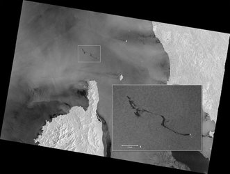
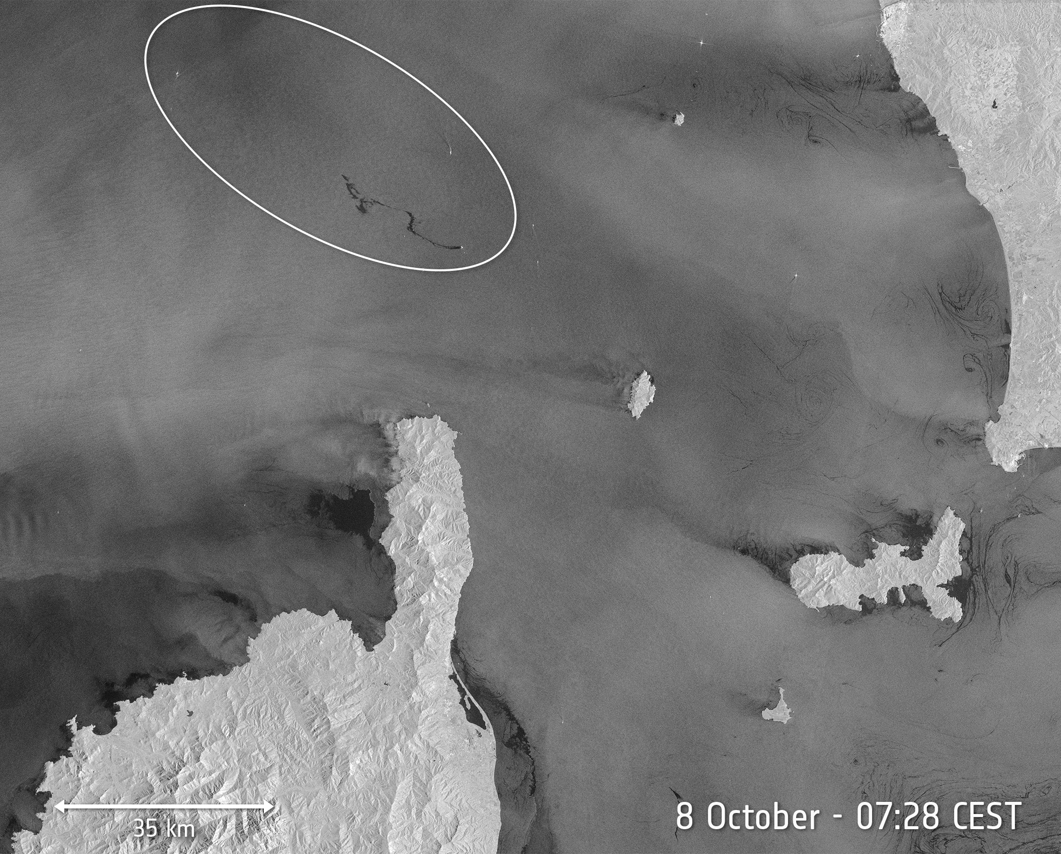
Grande America oil spill imaged
Captured just yesterday, 19 March, at 17:11 GMT (18:11 CET) by the Copernicus Sentinel-1 mission, this image shows the oil spill from the Grande America vessel. The Italian container ship, carrying 2200 tonnes of heavy fuel, caught fire and sank in the Atlantic, about 300 km off the French coast on 12 March.
Copernicus Sentinel-1 acquired this radar image of the oil slick, the large, dark patch visible in the centre of the image, stretching about 50 km. Marine vessels are identifiable as smaller white points, which could be those assisting in the clean-up process.
Oil is still emerging from the ship now lying at a depth of around 4500 metres. French authorities are trying to reduce the impact of pollution along the coast.
Sentinel-1 is a two-satellite constellation built for the European Commission’s Copernicus environmental monitoring programme. The identical satellites each carry an advanced radar instrument that can ‘see’ through the dark and through clouds.
Satellite radar is particularly useful for monitoring the progression of oil spills because the presence of oil on the sea surface dampens down wave motion. Since radar basically measures surface texture, oil slicks show up well – as black smears on a grey background.