About ESA
The European Space Agency (ESA) is Europe’s gateway to space. Its mission is to shape the development of Europe’s space capability and ensure that investment in space continues to deliver benefits to the citizens of Europe and the world.
Highlights


Latest


Space in Member States
Find out more about space activities in our 23 Member States, and understand how ESA works together with their national agencies, institutions and organisations.
 Germany
 Austria
 Belgium
 Denmark
 Spain
Spain
 Estonia
 Finland
 France
 Greece
 Hungary
 Ireland
 Italy
Italy
 Luxembourg
 Norway
 The Netherlands
 Poland
 Portugal
 Czechia
 Romania
 United Kingdom
 Slovenia
 Sweden
 Switzerland
Science & Exploration
Exploring our Solar System and unlocking the secrets of the Universe
Go to topicAstronauts


Latest


Enabling & Support
Making space accessible and developing the technologies for the future
Go to topicLatest


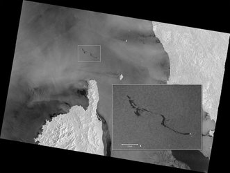
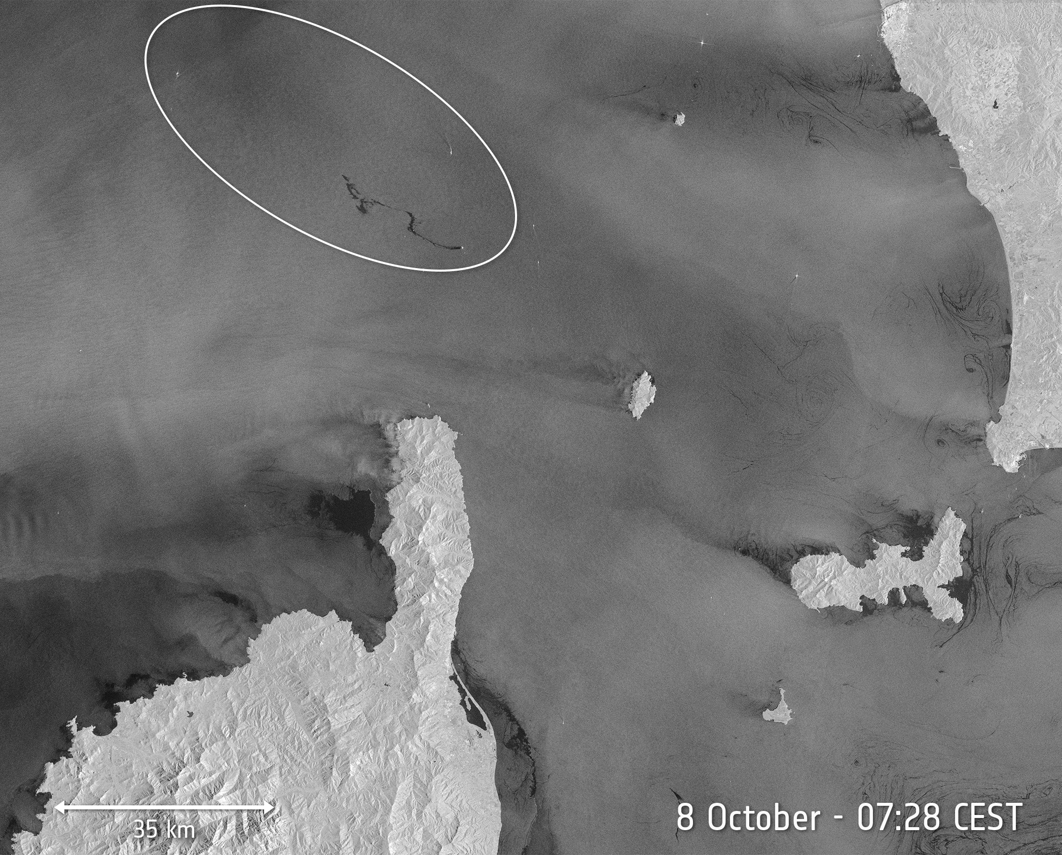
Mauritius oil spill
The island of Mauritius has declared a ‘state of environmental emergency’ after a grounded vessel began leaking tonnes of oil into the Indian Ocean. Satellite images, which show the dark slick spreading in the nearby waters, are being used to monitor the ongoing spill.
The MV Wakashio vessel, reported to be carrying nearly 4000 tonnes of oil, ran aground on a coral reef on Mauritius’s southeast coast on 25 July. According to media reports, more than 1000 tonnes of fuel have leaked from the cracked vessel into the ocean – polluting the nearby coral reefs, as well as the surrounding beaches and lagoons.
In this image, captured on 11 August by the Copernicus Sentinel-2 mission, the MV Wakashio, visible in the bottom of the image, is stranded close to Pointe d’Esny, an important wetland area. The oil slick can be seen as a thin, black line surrounded by the bright turquoise colours of the Indian Ocean. Oil is visible near the boat, as well as other locations around the lagoon.
In response to the spill, the International Charter Space and Major Disasters was activated on 8 August. The charter is an international collaboration that gives rescue and aid workers rapid access to satellite data in the event of a disaster. A full report that provides a preliminary assessment of the oil spill, using imagery from the Copernicus Sentinel-2 mission, is available here.
Copernicus Sentinel-2 is a two-satellite mission to supply the coverage and data delivery needed for Europe’s Copernicus programme. The mission’s frequent revisits over the same area and high spatial resolution allow changes in water bodies to be closely monitored.