About ESA
The European Space Agency (ESA) is Europe’s gateway to space. Its mission is to shape the development of Europe’s space capability and ensure that investment in space continues to deliver benefits to the citizens of Europe and the world.
Highlights


Latest


Space in Member States
Find out more about space activities in our 23 Member States, and understand how ESA works together with their national agencies, institutions and organisations.
 Germany
 Austria
 Belgium
 Denmark
 Spain
Spain
 Estonia
 Finland
 France
 Greece
 Hungary
 Ireland
 Italy
Italy
 Luxembourg
 Norway
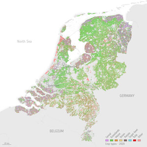
 The Netherlands
 Poland
 Portugal
 Czechia
 Romania
 United Kingdom
 Slovenia
 Sweden
 Switzerland
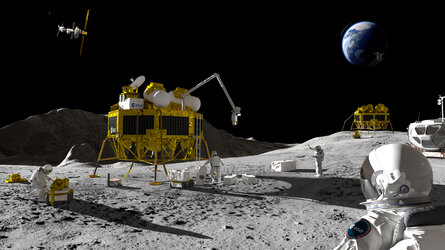
Science & Exploration
Exploring our Solar System and unlocking the secrets of the Universe
Go to topicAstronauts


Latest


Enabling & Support
Making space accessible and developing the technologies for the future
Go to topicLatest


Crop changes over one year
As a part of ESA’s SInCohMap project, which is dedicated to exploring innovative methodologies for land-cover and vegetation mapping using Sentinel-1 multitemporal coherence data, the usefulness of coherence time series for crop-type mapping has been demonstrated recently. A year-long time series of data from 2017 combined pairs of images of an agricultural area in Seville, Spain, from the two Sentinel-1 satellites. The images were used to classify 17 different crop types cultivated that year. Coherence was measured by using the pairs of consecutive images, acquired with a separation of six days, and also at two polarisations: VV and VH. The animation shows the presence of white and black rectangles in the cultivation area, according to the absence or presence of growing crops, and how they change along the year. As a side comment, there are some dates in fall (October and November) with a generalised low coherence, but they are due to rain events.