About ESA
The European Space Agency (ESA) is Europe’s gateway to space. Its mission is to shape the development of Europe’s space capability and ensure that investment in space continues to deliver benefits to the citizens of Europe and the world.
Highlights


Latest


Space in Member States
Find out more about space activities in our 23 Member States, and understand how ESA works together with their national agencies, institutions and organisations.
 Germany
 Austria
 Belgium
 Denmark
 Spain
Spain
 Estonia
 Finland
 France
 Greece
 Hungary
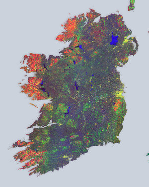
 Ireland
 Italy
Italy
 Luxembourg
 Norway
 The Netherlands
 Poland
 Portugal
 Czechia
 Romania
 United Kingdom
 Slovenia
 Sweden
 Switzerland
Science & Exploration
Exploring our Solar System and unlocking the secrets of the Universe
Go to topicAstronauts


Latest


Enabling & Support
Making space accessible and developing the technologies for the future
Go to topicLatest


Dublin, Ireland
Dublin, the capital and largest city of Ireland, is featured in this Copernicus Sentinel-2 image.
Zoom in to see this image at its full resolution or click on the circles to learn more about the features in it.
Dublin is located near the midpoint of Ireland’s east coast in the province of Leinster. The city, which covers an area of around 115 sq km, is bordered by the Dublin Mountains, a low mountain range to the south, and is surrounded by flat farmland to the north and west.
The city straddles the River Liffey, which rises in the Wicklow Mountains and flows around 80 km eastwards through the city of Dublin, in which it is canalised and bordered with quays. It then empties into Dublin Bay, an arm of the Irish Sea.
The city’s historical buildings include Dublin Castle, which dates back to the 13th Century, and St Patrick’s Cathedral. Dublin is also home to the Guinness Storehouse, which covers seven floors surrounding a glass atrium shaped in the form of a pint of Guinness. The seventh floor houses the Gravity Bar with spectacular views of Dublin.
There are many green spaces around Dublin which include Phoenix Park and St. Stephen’s Green. Phoenix Park, visible around 3 km west of the city centre, has a 16 km perimeter wall enclosing 707 hectares of green space making it one of the largest enclosed public parks in any capital city in Europe.
Dublin Bay is around 10 km wide along its north-south base and around seven km in length. North Bull Island, situated in the northwest part of the bay, features a five km long sandy beach, Dollymount Strand. Bull Island was created 200 years ago due to the construction of the north wall to Dublin Port and continues to grow seaward.
The island's habitats include beach, dunes, mud flats, grassland and marsh. The island was the first official bird sanctuary in the country in the 1930s. In 1981, it achieved status as a UNESCO Biosphere Reserve owing to its rare and threatened habitats and species along with its use by important numbers of overwintering birds.
Copernicus Sentinel-2 is a two-satellite mission. Each satellite carries a high-resolution camera that images Earth’s surface in 13 spectral bands. Data from Copernicus Sentinel-2 are used to monitor changes in land cover, agriculture, and coastal and inland waters.
This image is also featured on the Earth from Space video programme.