About ESA
The European Space Agency (ESA) is Europe’s gateway to space. Its mission is to shape the development of Europe’s space capability and ensure that investment in space continues to deliver benefits to the citizens of Europe and the world.
Highlights


Latest


Space in Member States
Find out more about space activities in our 23 Member States, and understand how ESA works together with their national agencies, institutions and organisations.
 Germany
 Austria
 Belgium
 Denmark
 Spain
Spain
 Estonia
 Finland
 France
 Greece
 Hungary
 Ireland
 Italy
Italy
 Luxembourg
 Norway
 The Netherlands
 Poland
 Portugal
 Czechia
 Romania
 United Kingdom
 Slovenia
 Sweden
 Switzerland
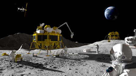
Science & Exploration
Exploring our Solar System and unlocking the secrets of the Universe
Go to topicAstronauts


Latest


Enabling & Support
Making space accessible and developing the technologies for the future
Go to topicLatest


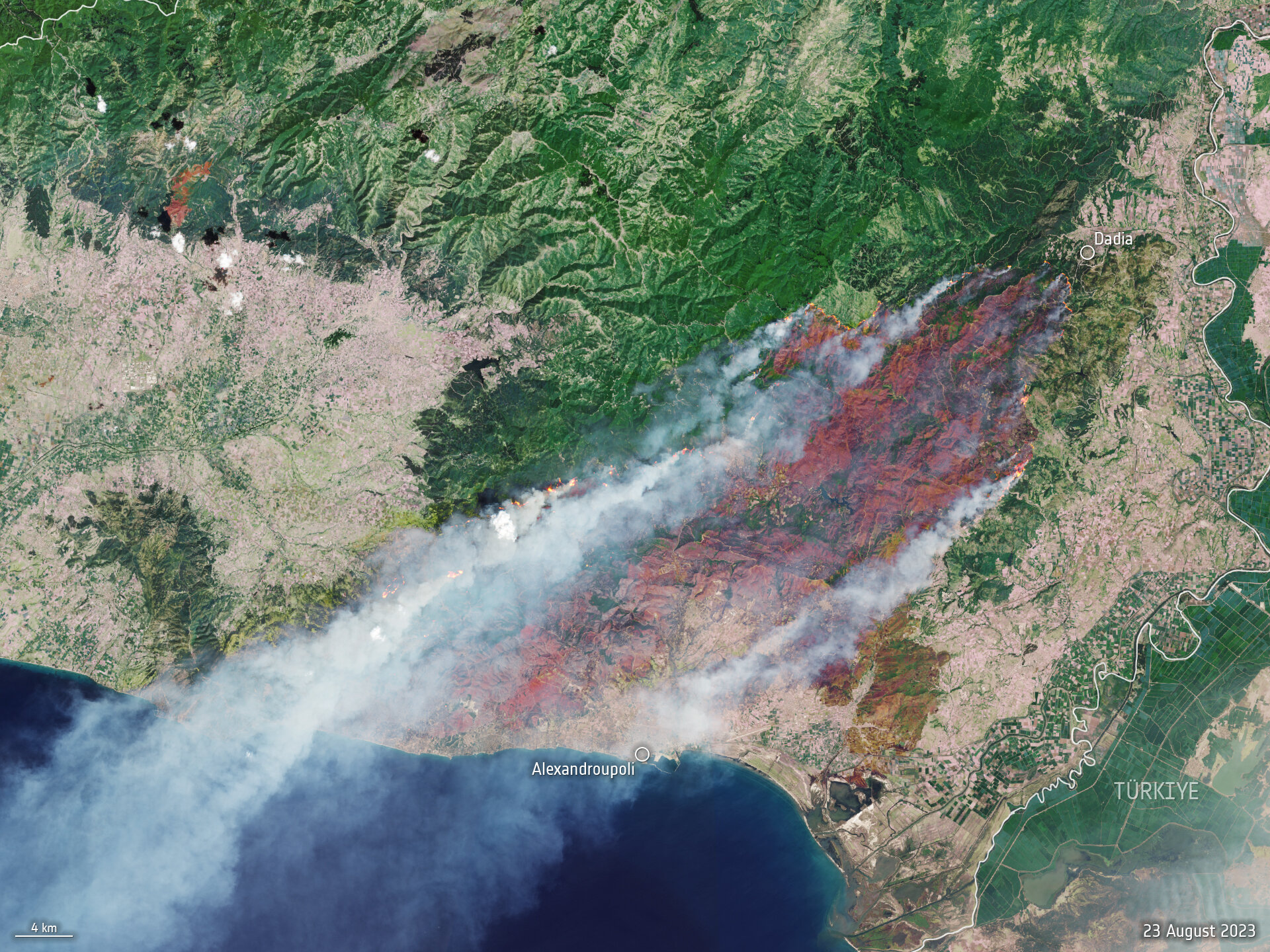
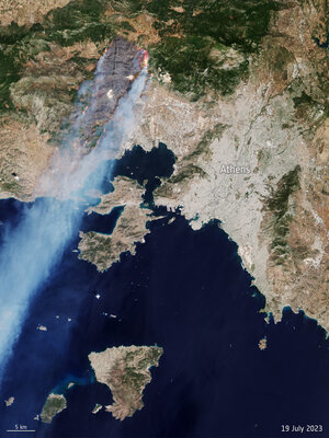
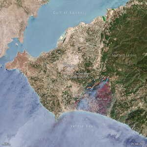
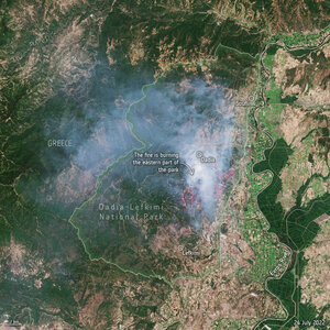
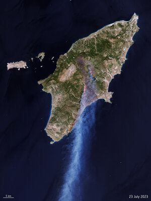
Wildfires continue to rage in Greece
A month after fires ravaged the island of Rhodes in July 2023, more fires have ripped through Greece this week as southern Europe swelters under a late summer heatwave. This Copernicus Sentinel-2 image shows the ongoing blaze near Alexandroupoli in the Evros region of northeast Greece – close to the Türkiye border.
Hot, dry and windy conditions have seen dozens of wildfires break out across Greece, with the most severe entering its fourth day and encroaching on the northeast port city of Alexandroupoli.
This satellite image is a blend between a natural colour and a shortwave infrared composite to highlight the fire front, which was approximately 70 km long when this image was captured on 23 August. The fire has produced a plume of smoke that stretched 1600 km southwest towards Tunisia. Burned area can be seen in the image in dark brown.
The Copernicus Sentinel-2 mission is based on a constellation of two identical satellites, each carrying an innovative wide swath high-resolution multispectral imager with 13 spectral bands for monitoring changes in Earth’s land and vegetation.
In response to the fires, the Copernicus Emergency Mapping Service has been activated in North Attica, Rodopi, Euboea Island, the Sterea Ellada Region, and East Macedonia. The service uses satellite observations to help civil protection authorities and, in cases of disaster, the international humanitarian community, respond to emergencies.
Climate change and land-use change are projected to make wildfires more frequent and intense. In light of the devastating wildfires, ESA has reopened its World Fire Atlas which provides a detailed analysis of wildfires taking place across the globe.