About ESA
The European Space Agency (ESA) is Europe’s gateway to space. Its mission is to shape the development of Europe’s space capability and ensure that investment in space continues to deliver benefits to the citizens of Europe and the world.
Highlights


Latest


Space in Member States
Find out more about space activities in our 23 Member States, and understand how ESA works together with their national agencies, institutions and organisations.
 Germany
 Austria
 Belgium
 Denmark
 Spain
Spain
 Estonia
 Finland
 France
 Greece
 Hungary
 Ireland
 Italy
Italy
 Luxembourg
 Norway
 The Netherlands
 Poland
 Portugal
 Czechia
 Romania
 United Kingdom
 Slovenia
 Sweden
 Switzerland
Science & Exploration
Exploring our Solar System and unlocking the secrets of the Universe
Go to topicAstronauts


Latest


Enabling & Support
Making space accessible and developing the technologies for the future
Go to topicLatest


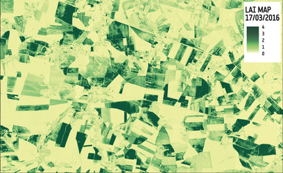
LAI in central Africa July 2010 and July 2018
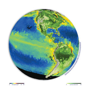
Climate modellers rely on satellite data to assess the health and growth of the world’s vegetation. ESA’s Climate Change Initiative’s latest data release provides a consistent time series to meet modellers’ needs. This new dataset comprises the Fraction of Absorbed Photosynthetically Active Radiation (FAPAR), which describes how much solar radiation is being absorbed by the leaves as well as information on Leaf Area Index (LAI), which describes the amount of leaf area in the canopy.
The images here show the difference in LAI over part of central Africa between July 2010 and July 2018. The images clearly show more arid areas, desert, to the north with low LAI and more dense vegetation to the south. The higher LAI in 2018 compared to 2010 is likely owing to the series of drought that had affected the area in 2008 and 2010, for example.
Read full story: Vegetation gets a boost with data from space