About ESA
The European Space Agency (ESA) is Europe’s gateway to space. Its mission is to shape the development of Europe’s space capability and ensure that investment in space continues to deliver benefits to the citizens of Europe and the world.
Highlights


Latest


Space in Member States
Find out more about space activities in our 23 Member States, and understand how ESA works together with their national agencies, institutions and organisations.
 Germany
 Austria
 Belgium
 Denmark
 Spain
Spain
 Estonia
 Finland
 France
 Greece
 Hungary
 Ireland
 Italy
Italy
 Luxembourg
 Norway
 The Netherlands
 Poland
 Portugal
 Czechia
 Romania
 United Kingdom
 Slovenia
 Sweden
 Switzerland
Science & Exploration
Exploring our Solar System and unlocking the secrets of the Universe
Go to topicAstronauts


Latest


Enabling & Support
Making space accessible and developing the technologies for the future
Go to topicLatest


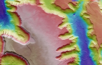
Topography of Angustus Labyrinthus
This colour-coded topographic image shows a slice of terrain in the south polar region of Mars. It features a region nicknamed Inca City (more formally named Angustus Labyrinthus), which is characterised by linear ridges reminiscent of Inca ruins, and traces of small, dark features known as ‘spiders’. These form as carbon dioxide gas warms up in sunlight and breaks through slabs of overlying ice.
This view was created from data collected by ESA’s Mars Express on 27 February 2024 and is based on a digital terrain model of the region, from which the topography of the landscape can be derived. Lower parts of the surface are shown in blues and purples, while higher altitude regions show up in whites and reds, as indicated on the scale to the top right.
North is to the upper right. The ground resolution is approximately 15 m/pixel and the image is centred at 300°E/79°S.
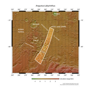
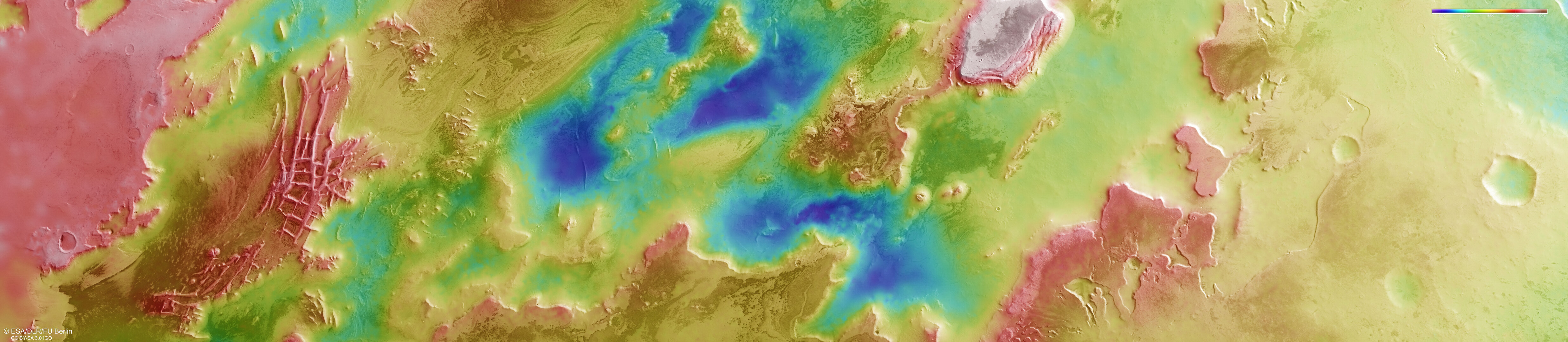
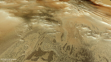
A broader view: Angustus Labyrinthus and surroundings
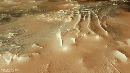
Perspective view of Mars’s Inca City
Perspective view of Mars’s Inca City
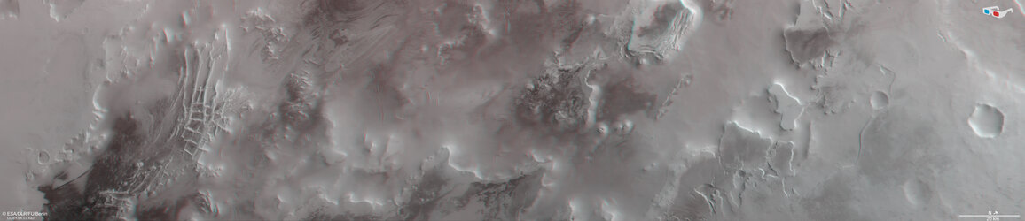
Mars’s Inca City and south polar region in 3D