About ESA
The European Space Agency (ESA) is Europe’s gateway to space. Its mission is to shape the development of Europe’s space capability and ensure that investment in space continues to deliver benefits to the citizens of Europe and the world.
Highlights


Latest


Space in Member States
Find out more about space activities in our 23 Member States, and understand how ESA works together with their national agencies, institutions and organisations.
 Germany
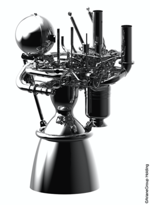
 Austria
 Belgium
 Denmark
 Spain
Spain
 Estonia
 Finland
 France
 Greece
 Hungary
 Ireland
 Italy
Italy
 Luxembourg
 Norway
 The Netherlands
 Poland
 Portugal
 Czechia
 Romania
 United Kingdom
 Slovenia
 Sweden
 Switzerland
Science & Exploration
Exploring our Solar System and unlocking the secrets of the Universe
Go to topicAstronauts


Latest


Enabling & Support
Making space accessible and developing the technologies for the future
Go to topicLatest


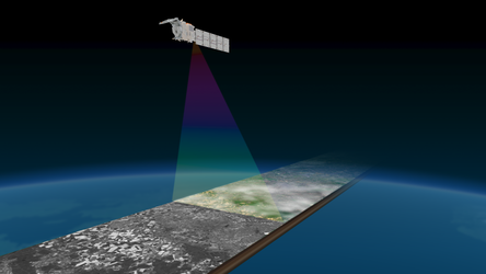
Southwest coast of Greenland from EarthCARE’s multispectral imager
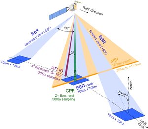
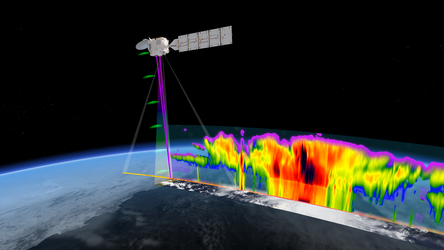
ESA’s EarthCARE satellite was launched on 29 May 2024. It has already returned images from its cloud profiling radar and from its broadband radiometer. Now, it has also delivered the first images from its multispectral imager, showcasing various types of clouds and cloud temperatures worldwide. This instrument is set to add valuable context to the data from EarthCARE’s other instruments.
The multispectral imager comprises two cameras: one imaging in the visible, near-infrared and shortwave-infrared (VIS-NIR-SWIR) parts of the of the electromagnetic spectrum and one in the thermal-infrared (TIR). Images captured with these different spectral bands will allow scientists to differentiate between various cloud types, aerosols and Earth’s surface.
This image from 17 July, shows the coastline along the south-western tip of Greenland. The ice- and snow-free coastal area reached temperatures of up to 10°C that day, which can be seen by the sharp contrast between the Greenland ice sheet and the cold ocean. The combination of the visible and infrared images nicely picks out the ice clouds and water clouds over the ice sheet, and the shallow cloud layer over the sea in the southwest corner.
Read full story: EarthCARE’s multispectral imager puts clouds into context