About Eduspace What is Eduspace?What tools does it offer? Choose your language… Remote Sensing Principles What is remote sensing?Remote sensing in depthHistory of Earth observationMapping and satellite dataSatellite orbitsEarth observation satellites Resources… Multimedia Image GalleryVideo GalleryServices Contact usSearch in Eduspace
|  | | | | | | | Article Images |  |
Observed objects
| Meteorological satellite network: as at March 2002 the WMO community can rely on data from four polar orbiting and five geostationary satellites. Image: WMO
Credits: WMO | |  |  | |
| | | | | On the upper left image, the satellite is placed on an orbit relatively far from the Earth (± 36 000 km). This is why it is
possible to see the "whole" planet.
Credits: ESA | | | | |
| | | | | On this figure, the satellite orbit is much closer to the Earth (± 800 km). Each square (black and red) represents one image. When several images are joined to each other to form a bigger image, scientists talk about a 'mosaic' being created.
Credits: ESA | | | | |
| | | | | West London TM image.
Credits: Window on the UK 2000 | | | | |
| | | | | West London aerial map.
Credits: Window on the UK 2000 | | | | |
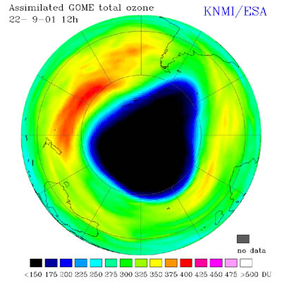
| | | | | Ozone hole over the South Pole during September 2001 taken by GOME. Image: KNMI, The Netherlands
Credits: KNMI, The Netherlands | | | | |
| |
| | Elements of remote sensing PlatformsSensorsThe information contained in an image
|