


 Germany
 Austria
 Belgium
 Denmark
 Spain
Spain
 Estonia
 Finland
 France
 Greece
 Hungary
 Ireland
 Italy
Italy
 Luxembourg
 Norway
 The Netherlands
 Poland
 Portugal
 Czechia
 Romania
 United Kingdom
 Slovenia
 Sweden
 Switzerland


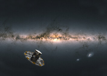
A first: EarthCARE reveals inner secrets of clouds
Less than a month after it was launched, ESA’s EarthCARE satellite has returned the first image from one of its instruments – an image that, for the first time from space, unveils the internal structure and dynamics of clouds.
This remarkable first image, captured by the satellite’s cloud profiling radar, offers a mere glimpse of the instrument's full potential once it is fully calibrated.
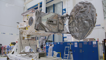
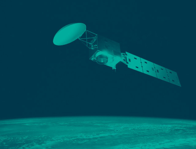
EarthCARE carries four sophisticated instruments that have been designed to work in harmony to shed new light on the role that clouds and aerosols play in heating and cooling Earth’s atmosphere, thereby contributing to a better understanding of climate change.

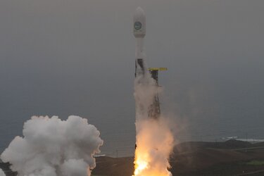
Launched just a matter of a few weeks ago, on 29 May, EarthCARE has already delivered its first image from the cloud profiling radar instrument, which was provided by the Japan Aerospace Exploration Agency, JAXA.
The first data from the satellite’s three European instruments – the broadband radiometer, the atmospheric lidar and the multispectral imager – are expected in the next weeks and months.
JAXA’s Mission Scientist for the cloud profiling radar, Takuji Kubota, said, “We are thrilled to be able to present this first image, which reveals detail on the internal structure of cloud dynamics over the ocean, east of Japan on 13 June.
“This is the first image of its kind – we have never had this kind of information measured from space before. It is all we hoped for, and more. I believe that the cloud profiling radar will bring various scientific discoveries.”

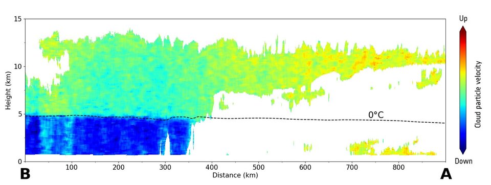
This first image is displayed above in two parts. On the left, the data unveils the vertical concentration of cloud particles measured as radar reflectivity. It is clear to see that the denser part of the cloud is in its centre where there are more large particles and the particles are large.
On the right, we see the fall speed of the cloud particles. The low values in the upper layer indicate ice crystals and snowflakes that are suspended or falling slowly. In the layer beneath, the much higher fall speed values indicate rain.
Both images show a clear boundary at an altitude of around 5 km, which is where the ice and snow melt, forming water droplets that fall as rain.
The cloud profiling radar uses its Doppler velocity capability to measure the vertical speed of motion of the ice, snow and rain.

This detailed information about the density, distribution by size and velocity of particles allows scientists to distinguish cloud constituents and hence better understand their physics.
Thanks to EarthCARE, this is the first time that this measurement has ever been provided from space.
To give some context to these first results, the image on the right shows the same cloud system captured by the Japanese Himawari-9 meteorological satellite in geostationary orbit, around 36 000 km above Earth. The image has been overlaid with EarthCARE’s orbital track.
EarthCARE’s cloud profiling radar captured its first data between the A and B markers in this image.

Then the next two images show the vertically-resolved concentration of cloud particles measured in radar reflectivity and vertically-resolved velocity of the cloud particles from EarthCARE's cloud profiling radar data between the A and B markers in the Himawari-9 image.
Conventionally, these data can only be obtained by cloud radar on the ground or on aircraft. These methods can only measure limited areas, but the cloud profiling radar aboard the EarthCARE satellite allows cloud structure to be measured uniformly across the entire planet.
ESA’s Director for Earth Observation Programmes, Simonetta Cheli, added, “This is a fantastic first result from our JAXA partners, and a true indication of what we can expect in the future when the satellite and all of its instruments are fully calibrated and commissioned.
“We now look forward to seeing the first results from EarthCARE’s other three instruments.
“The key to the mission is having all four instruments working together to give us a holistic understanding of the highly complex interactions between clouds, aerosols, incoming solar radiation and outgoing thermal radiation to help better predict future climate trends.”