Germany
 Austria
 Belgium
 Denmark
 Spain
Spain
 Estonia
 Finland
 France
 Greece
 Hungary
 Ireland
 Italy
Italy
 Luxembourg
 Norway
 The Netherlands
 Poland
 Portugal
 Czechia
 Romania
 United Kingdom
 Slovenia
 Sweden
 Switzerland


EarthCARE’s multispectral imager puts clouds into context
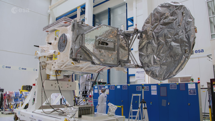
Launched less than two months ago, ESA’s EarthCARE satellite has already returned images from two of its four instruments. Now, it has also delivered the first images from its multispectral imager, showcasing various types of clouds and cloud temperatures worldwide. This instrument is set to add valuable context to the data from EarthCARE’s other instruments.
Equipped with four state-of-the-art instruments – a cloud profiling radar, an atmospheric lidar, a broadband radiometer and a multispectral imager – EarthCARE makes a range of different measurements simultaneously. Together, these measurements will help to understand how clouds and aerosols reflect incoming solar energy back out to space and how they trap outgoing infrared energy.
This information is crucial for understanding how climate change is affecting Earth’s energy balance and for predicting the rate at which clouds and aerosols could lose their current overall cooling effect in the future.
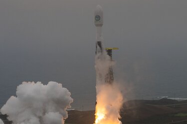
EarthCARE was launched into orbit around Earth on 29 May. A mere month later, this remarkable satellite returned the first images from the cloud profiling radar, shortly followed by the first images from the broadband radiometer.

After spending a few weeks after being launched with its optical system protected during the initial release of gases trapped in the satellite, the multispectral imager has added to the list of EarthCARE’s impressive first results.
The lidar and radar provide profiles in a rather thin curtain directly underneath the satellite. However, the multispectral imager provides a much wider field-of-view of 160 km, which gives context to the profiles and allows them to be extended into wider 3D scenes.
The multispectral imager also provides spectral information used to improve the accuracy of the broadband radiometer observations. It comprises two cameras: one imaging in the visible, near-infrared and shortwave-infrared (VIS-NIR-SWIR) parts of the of the electromagnetic spectrum and one in the thermal-infrared (TIR). Images captured with these different spectral bands will allow scientists to differentiate between various cloud types, aerosols and Earth’s surface.
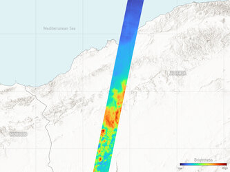
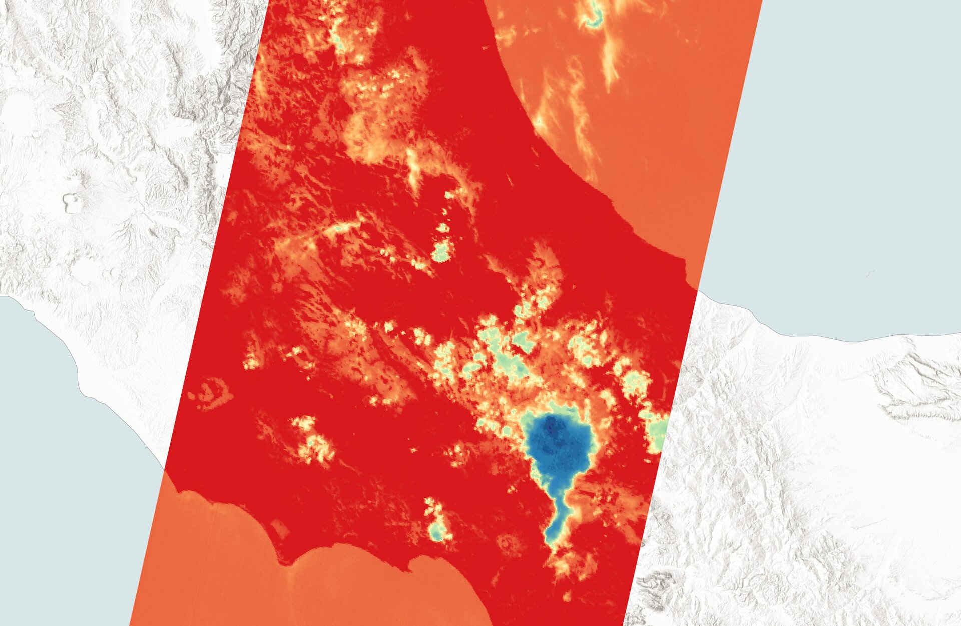
The first image captures a thunderstorm west of Rome in Italy on 17 July. The true-colour part of the image on the left shows a very clear large single cloud. This storm cloud is likely to have been 11 km high. The right part of the image, which uses the instrument’s thermal-infrared band, shows that the top of this storm cloud was about –50°C, and that the land below was about 30°C. The thermal-infrared part also picks out the surrounding lower clouds, particularly over the Adriatic Sea, much better than the true-colour image.

The second image shows orographic clouds – clouds formed by the shape of the land below – resulting from low westerly winds over the northern-most Kuril Islands on 17 July. These shallow clouds probably didn’t reach much higher than a few hundred meters. The thermal-infrared part of the image on the right shows little difference in temperature between the cloud and the sea surface.

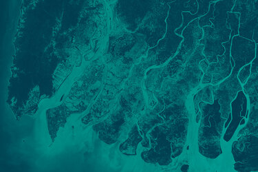
Above, the third image, also from 17 July, shows the coastline along the south-western tip of Greenland. The ice and snow-free coastal area reached temperatures of up to 10°C that day, which can be seen by the sharp contrast between the Greenland ice sheet and the cold ocean. The combination of the visible and infrared images nicely picks out the ice clouds and water clouds over the ice sheet, and the shallow cloud layer over the sea in the southwest corner.
Then the image below is from 16 July and shows part of mid-western and southern US. The bottom of the image shows a hot cloud-free northern Arkansas. Both images then feature part of a frontal system, with the thermal-infrared image highlighting cold high clouds in blue over southern Missouri. The middle of both images show fewer clouds north of the frontal system. The thermal-infrared image shows low warm clouds at the top of the image.

ESA’s Director of Earth Observation Programmes, Simonetta Cheli, “This is another great result from EarthCARE, giving us a glimpse into what the mission will deliver after it is fully commissioned.
“The multispectral imager will be key to adding context to the satellite’s other three instruments to advance complicated science on Earth’s energy balance. We now eagerly await the first images from EarthCARE’s atmospheric lidar.”