Accept all cookies Accept only essential cookies See our Cookie Notice

About ESA
The European Space Agency (ESA) is Europe’s gateway to space. Its mission is to shape the development of Europe’s space capability and ensure that investment in space continues to deliver benefits to the citizens of Europe and the world.
Highlights
ESA - United space in Europe
This is ESA ESA facts Member States & Cooperating States Funding Director General Top management For Member State Delegations European vision European Space Policy ESA & EU Space Councils Responsibility & Sustainability Annual Report Calendar of meetings Corporate newsEstablishments & sites
ESA Headquarters ESA ESTEC ESA ESOC ESA ESRIN ESA EAC ESA ESAC Europe's Spaceport ESA ESEC ESA ECSAT Brussels Office Washington OfficeWorking with ESA
Business with ESA ESA Commercialisation Gateway Law at ESA Careers Cyber resilience at ESA IT at ESA Newsroom Partnerships Merchandising Licence Education Open Space Innovation Platform Integrity and Reporting Administrative Tribunal Health and SafetyMore about ESA
History ESA Historical Archives Exhibitions Publications Art & Culture ESA Merchandise Kids Diversity ESA Brand Centre ESA ChampionsLatest
Space in Member States
Find out more about space activities in our 23 Member States, and understand how ESA works together with their national agencies, institutions and organisations.
Science & Exploration
Exploring our Solar System and unlocking the secrets of the Universe
Go to topicAstronauts
Missions
Juice Euclid Webb Solar Orbiter BepiColombo Gaia ExoMars Cheops Exoplanet missions More missionsActivities
International Space Station Orion service module Gateway Concordia Caves & Pangaea BenefitsLatest
Space Safety
Protecting life and infrastructure on Earth and in orbit
Go to topicAsteroids
Asteroids and Planetary Defence Asteroid danger explained Flyeye telescope: asteroid detection Hera mission: asteroid deflection Near-Earth Object Coordination CentreSpace junk
About space debris Space debris by the numbers Space Environment Report In space refuelling, refurbishing and removingSafety from space
Clean Space ecodesign Zero Debris Technologies Space for Earth Supporting Sustainable DevelopmentLatest
Applications
Using space to benefit citizens and meet future challenges on Earth
Go to topicObserving the Earth
Observing the Earth Future EO Copernicus Meteorology Space for our climate Satellite missionsCommercialisation
ESA Commercialisation Gateway Open Space Innovation Platform Business Incubation ESA Space SolutionsLatest
Enabling & Support
Making space accessible and developing the technologies for the future
Go to topicBuilding missions
Space Engineering and Technology Test centre Laboratories Concurrent Design Facility Preparing for the future Shaping the Future Discovery and Preparation Advanced Concepts TeamSpace transportation
Space Transportation Ariane Vega Space Rider Future space transportation Boost! Europe's Spaceport Launches from Europe's Spaceport from 2012Latest

Jakarta - MERIS - 23 October 2003
Thank you for liking
You have already liked this page, you can only like it once!
This Medium Resolution Imaging Spectrometer (MERIS) image shows part of the Sumatra (left) and Java (right) islands in western Indonesia. Both islands are separated by the Sunda Strait, which joins the Java Sea (top) with the Indian Ocean (bottom). The Krakatoa island, famous by a strong volcanic eruption in 1883, is in the strait. An explosion in the eruption series produced one of the loudest noises in the history; it was heard at a distance of 4800 km. Jakarta, capital and largest city of the Republic of Indonesia is on the northwest coast of the Java island, which is traversed by a volcanic mountain chain, including about 35 active craters. The capital, called Batavia by the Dutch, was the capital of the Netherlands Indies for most of the 17th through early 20th centuries.
Technical Information:
Instrument: MEdium Resolution Imaging Spectrometer (MERIS)
Date of Acquisition: 23 October 2003
Orbit number: 08603
Orbit direction: Descending
Instrument features: Full Resolution image (300 metre resolution)
Band combination: R = 665 nm, G = 560 nm, B = 442.5 nm
Coordinates:
NE Lat/Long: S 2.84 / E 112.21
NW Lat/Long: S 0.60 / E 102.89
SW Lat/Long: S 6.43 / E 101.58
SE Lat/Long: S 8.67 / E 110.96
-
CREDIT
ESA 2004 -
LICENCE
ESA Standard Licence and Additional permission may be required
(contact spaceinimages@esa.int for further information)

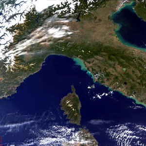
Central Italy and Island of Corse - MERIS - 6 October 2003

South of Italy - MERIS - 10 October 2003

Madagascar - MERIS - 13 August 2003

Cyprus - MERIS, 20 June 2003


 Germany
 Austria
 Belgium
 Denmark
 Spain
Spain
 Estonia
 Finland
 France
 Greece
 Hungary
 Ireland
 Italy
Italy
 Luxembourg
 Norway
 The Netherlands
 Poland
 Portugal
 Czechia
 Romania
 United Kingdom
 Slovenia
 Sweden
 Switzerland


